
If you are passionate about canyoning, then it is highly likely you either own or have come across Daniel Clearwater’s guidebook – Canyoning in New Zealand. As far as canyoning guide books go, this is the GOAT.
Fully inspired by all the incredible canyons featured in this guidebook, and with a love of New Zealand shared amongst friends, a trip was conceptualised!
Then I thought (as ambitiously as I typically do)… why not add 2 of New Zealand’s great walks on the agenda? Which received a unanimous ‘Hell Yeah!’.
Heck, why not just make it a complete lap around the South Island?!
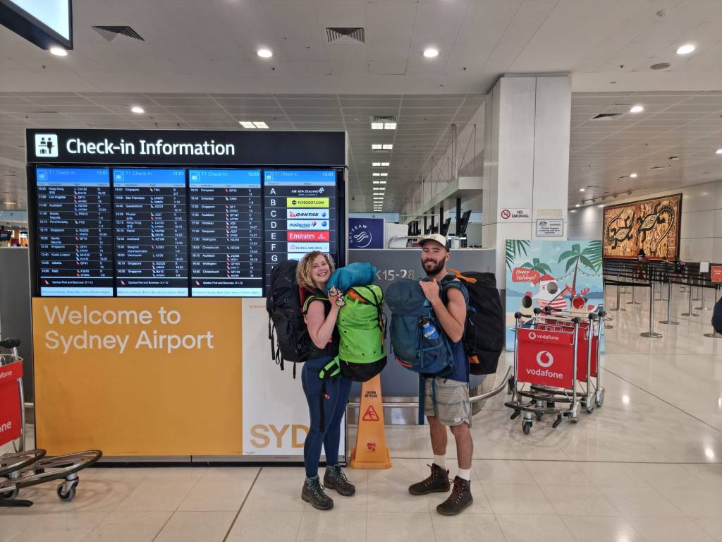
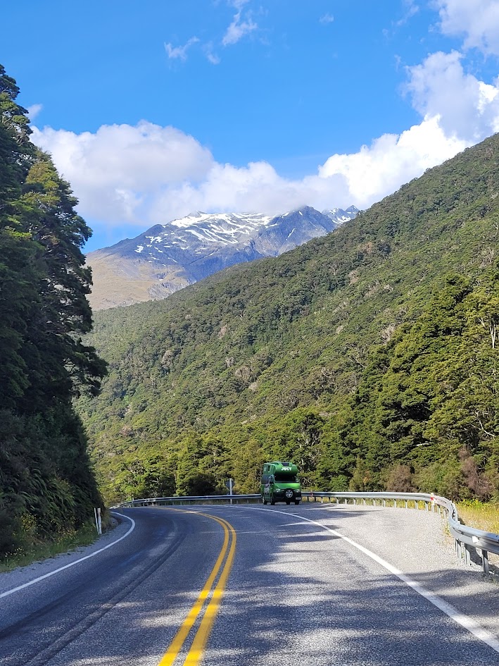
Flights were booked, one very green jucy van booked, 2x great walks booked and 3x friends united, the trip was a go!
Let’s see how much we can physically (and literally) fit into a 3 week trip.
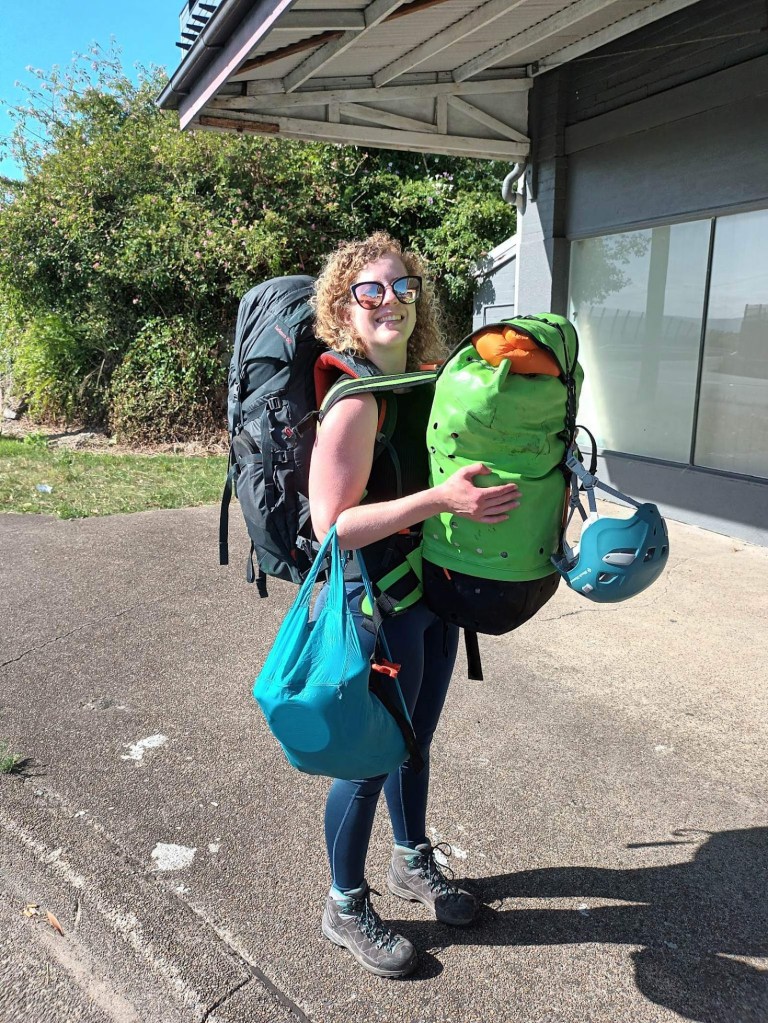
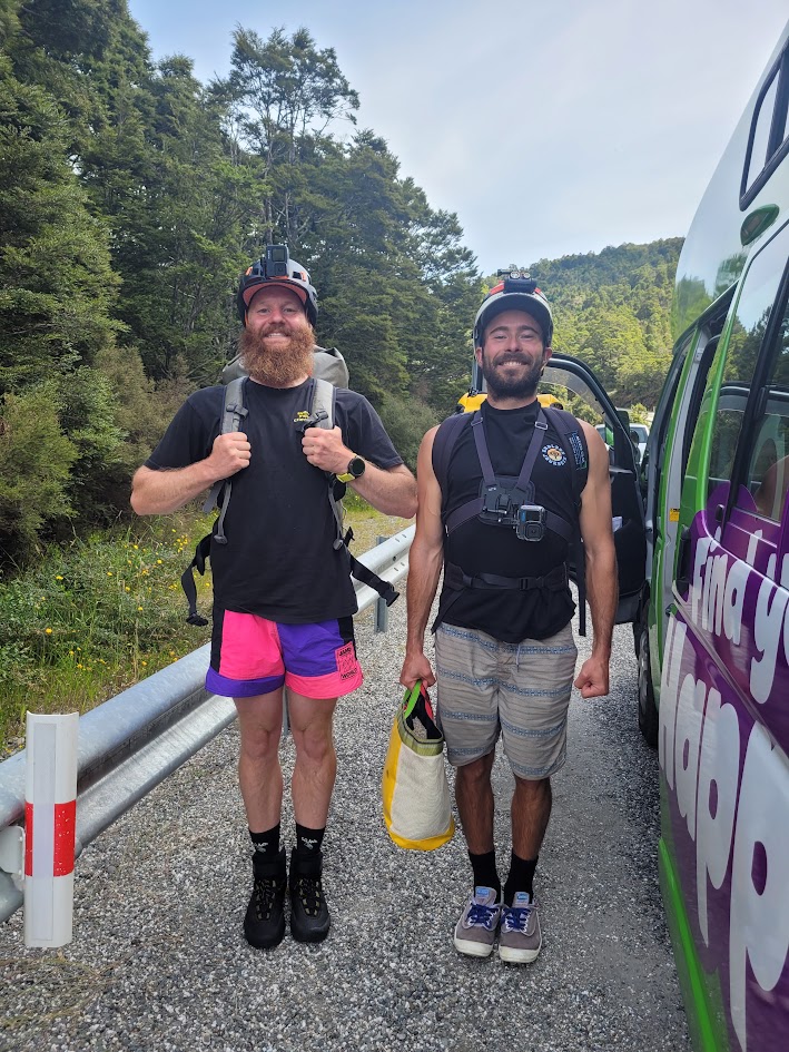
This is what travelling with a full hiking bag and a full canyoning gear bag looks like! I am still shocked at how much gear I was able to fit into these 2 packs.
What we did:
- Kepler Track
- Lake Marian
- Milford Sound
- Gertrude Saddle
- Camp Creek Canyon
- Blue Pools
- Cross Creek Canyon
- Robinson Creek Canyon
- Fantail Falls
- Thunder Creek Falls
- Franz Joseph Glacier
- Hokitika Gorge
- Carew Creek Canyon
- Ford Creek Canyon
- Split Apple Rock
- Harwoods Hole
- Twin Creek Canyon
- Devils Punchbowl Falls
- Cave Stream
- Rakaia Gorge Bridge
- Hooker Valley Track
- Routeburn Track
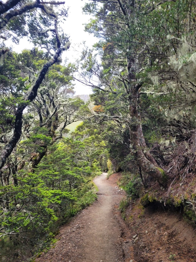
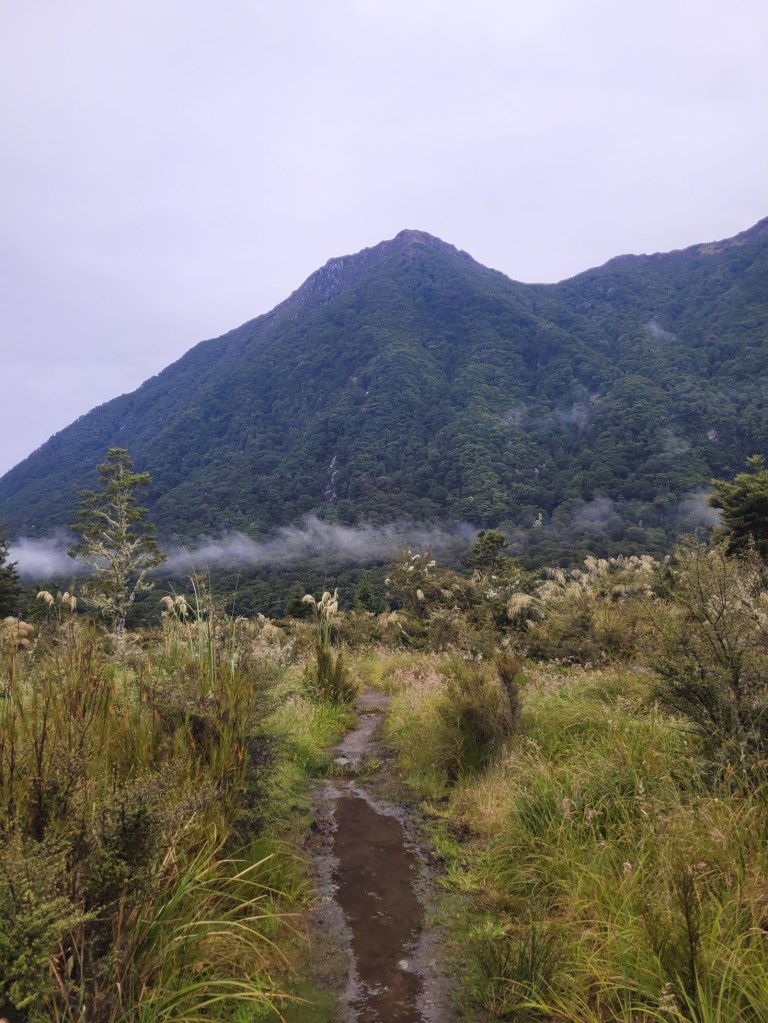
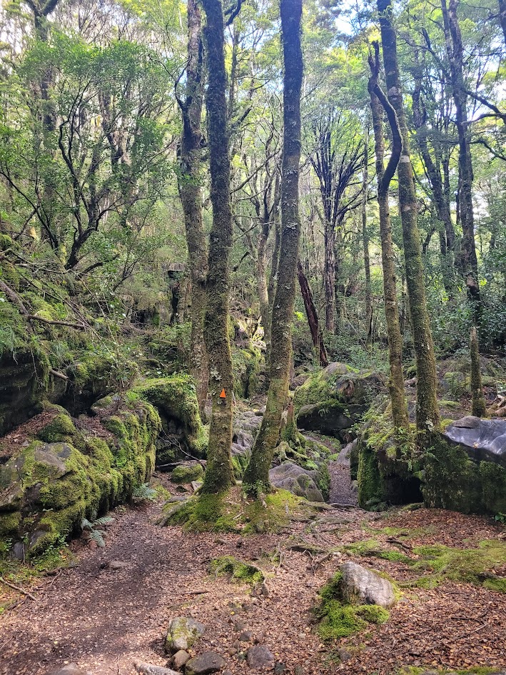
Kepler Track
To this day, the Kepler track is still the best multi-day hike I have been on, and my favourite NZ Great Walk.
The views are simply unmatched, with a beautiful mix of forest walking and high altitude mountain ridgelines.
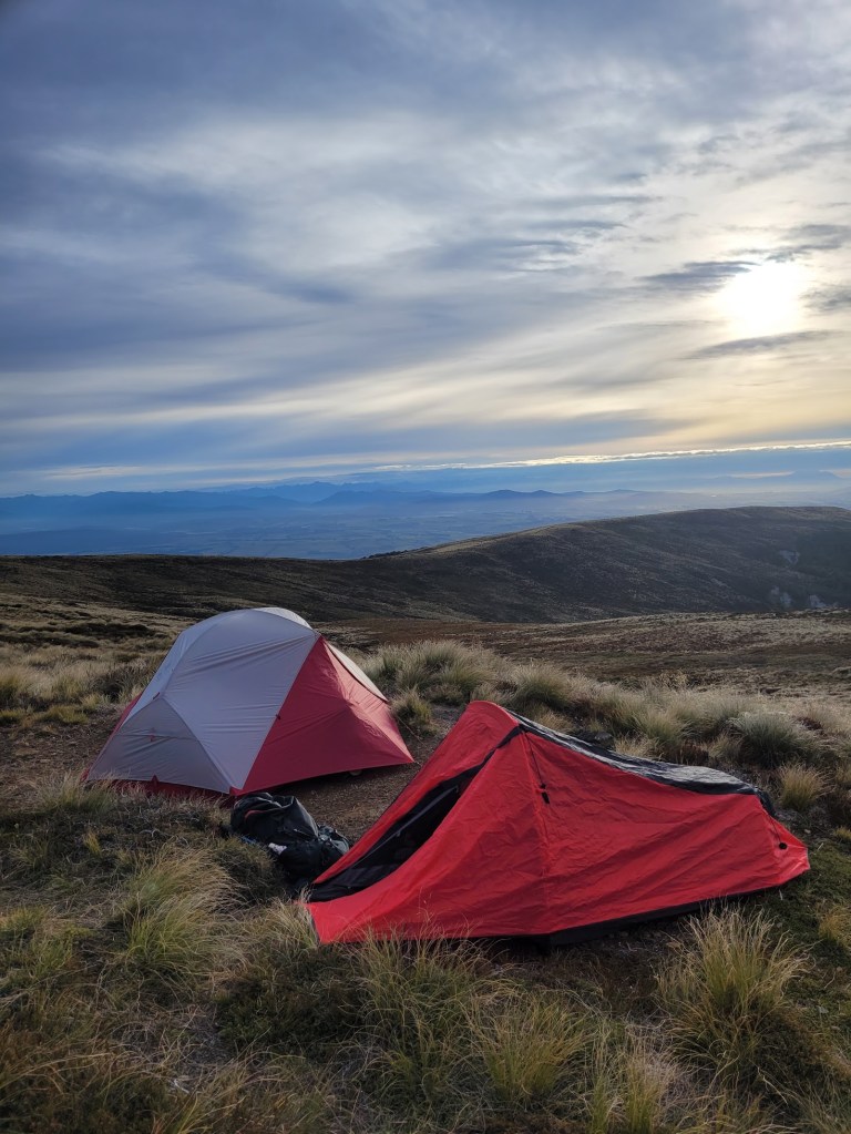
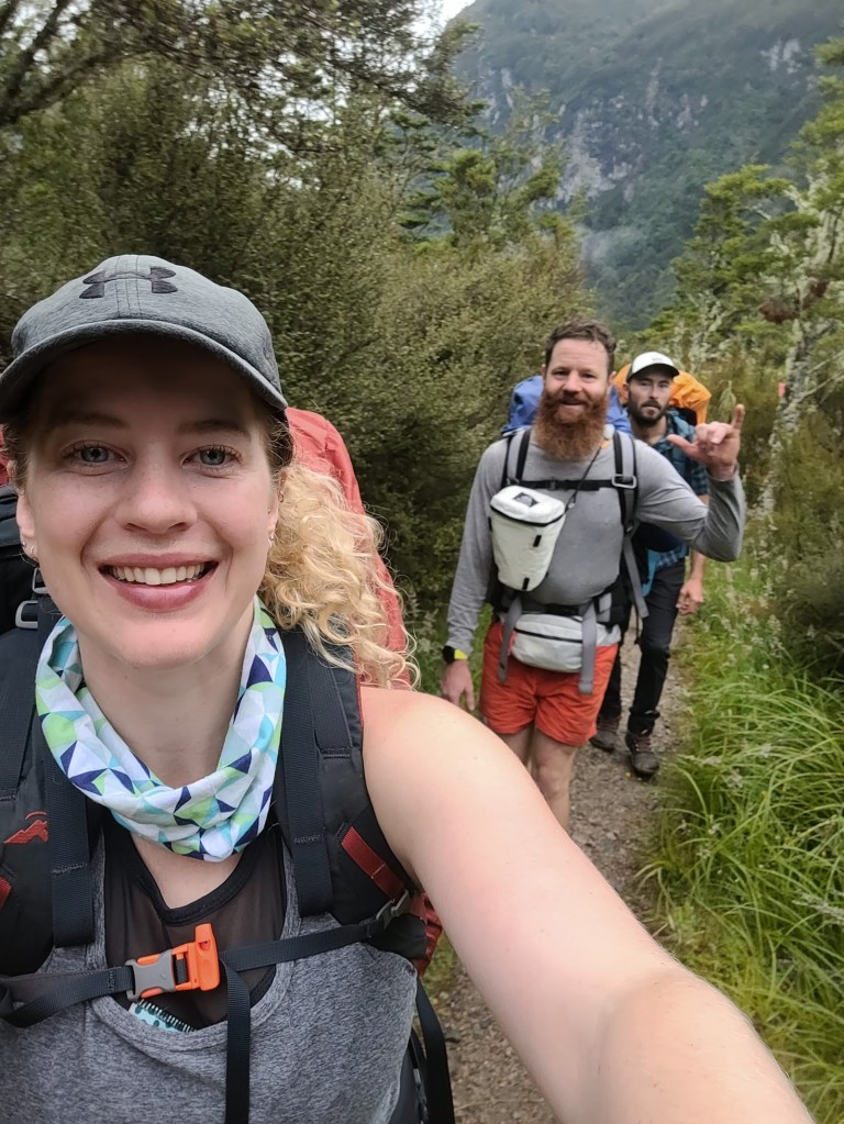
We had booked quite late in the season, so there was no staying in the huts for us, which added extra weight in the packs carrying tents.
Day 1
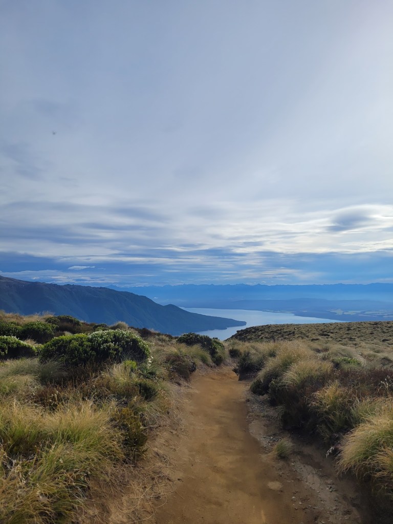
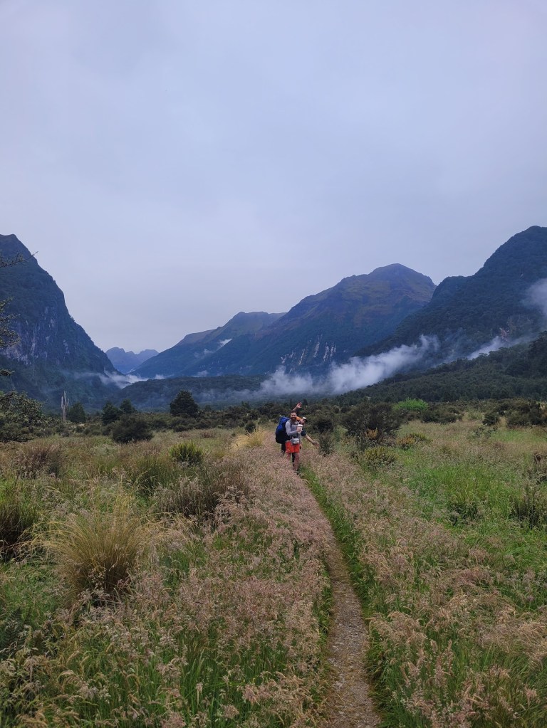
The first couple of kilometres are pretty chill as you walk along the forest floor with views of Lake Te Anau on your right.
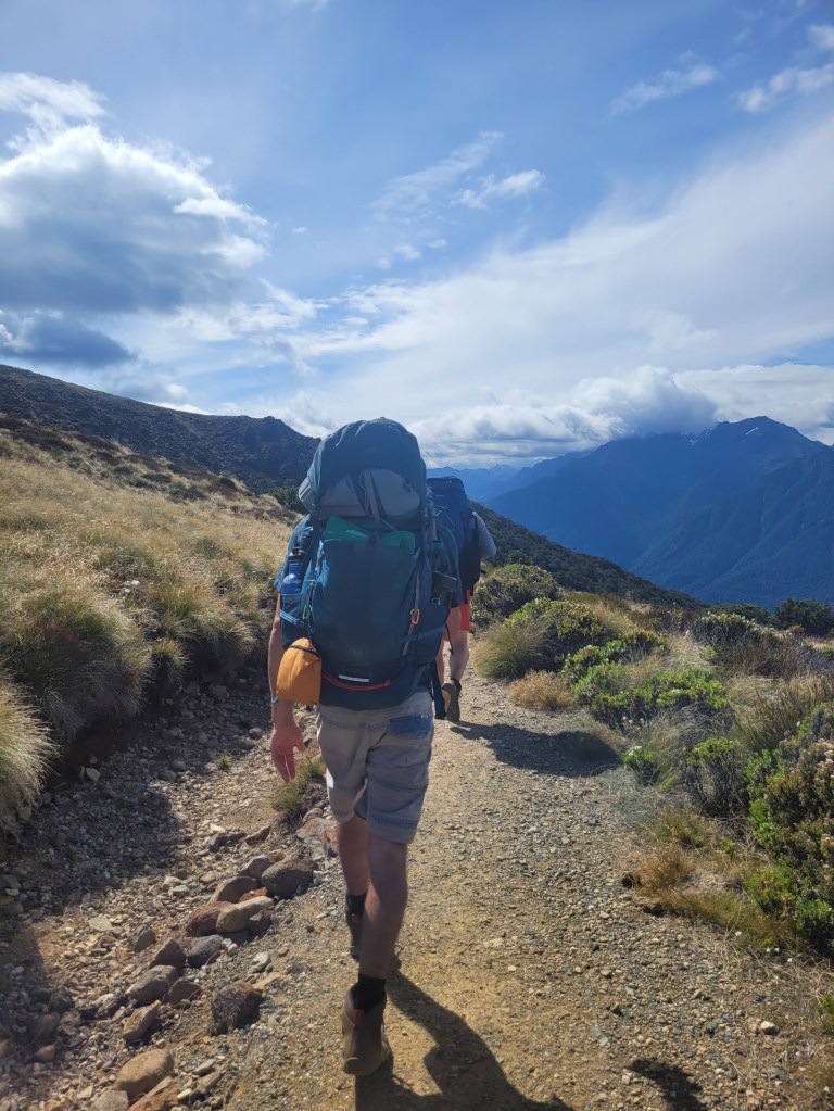
Before long though, you start the 800m elevated slog to the top of the ridgeline and it is BRUTAL. At least for an unprepared gal who doesn’t typically train for her hikes and was certainly carrying plenty of luxuries.
But at the top, the pain of the slog quickly fades away as you take in these magnificent views, and the feeling of accomplishment of simply getting there!
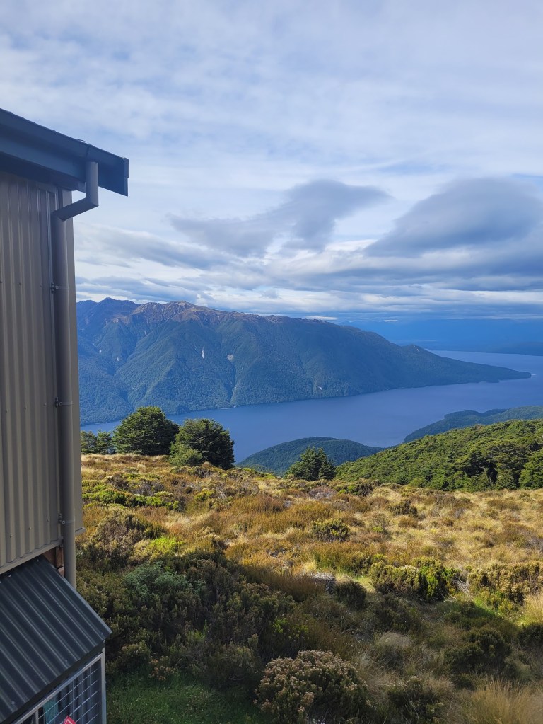
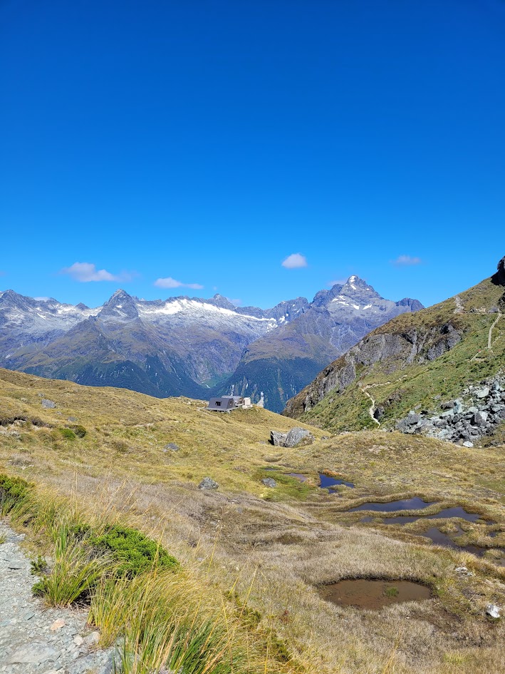
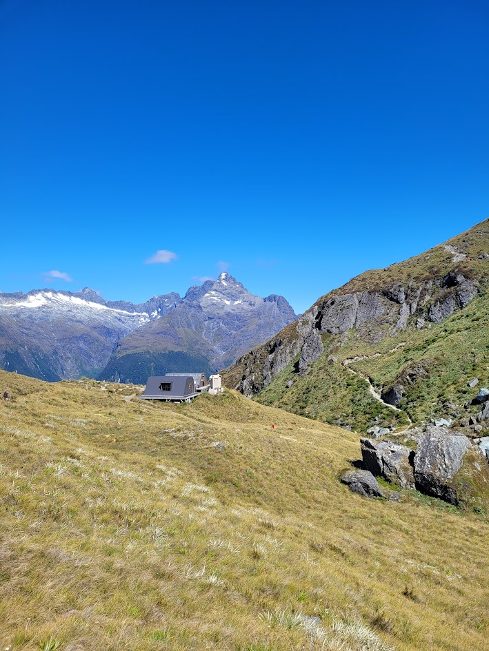
The first hut on the Kepler Track is Luxmore Hut, which has some of the best views I have seen from any mountain hut.
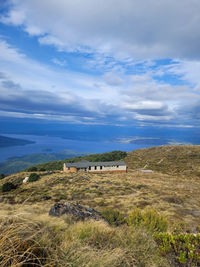
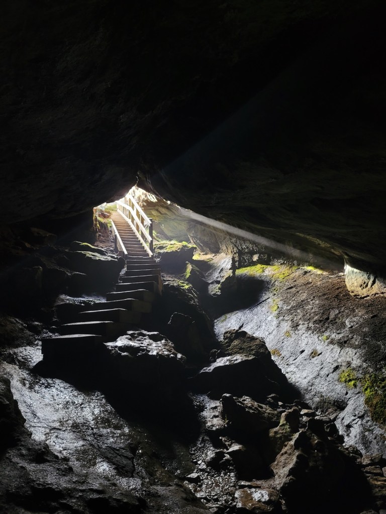
Unfortunately for us we couldn’t stay in the hut, so we kept going until we found a good spot to wild camp, and also decided to do a side trip to visit Luxmore Cave!
Day 2
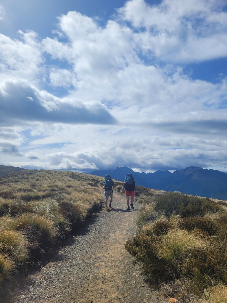
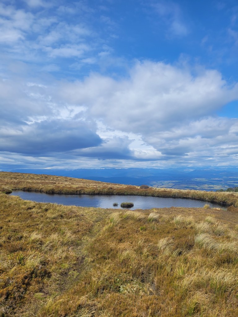
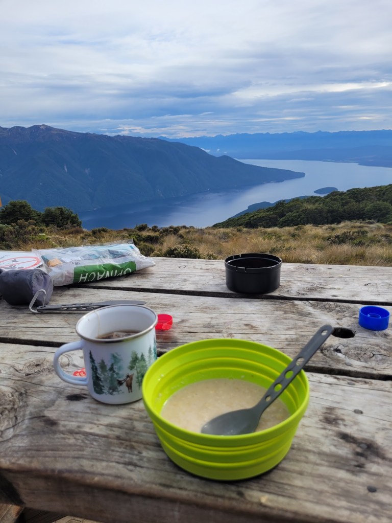
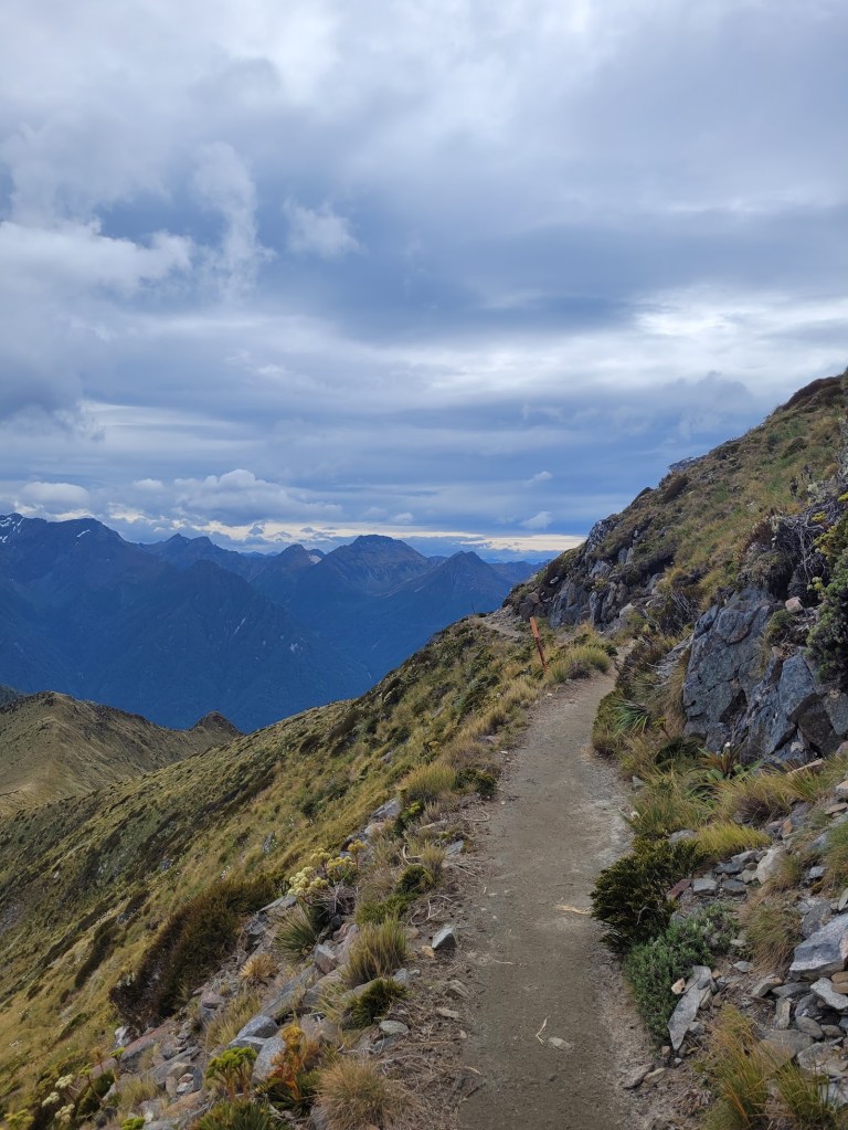
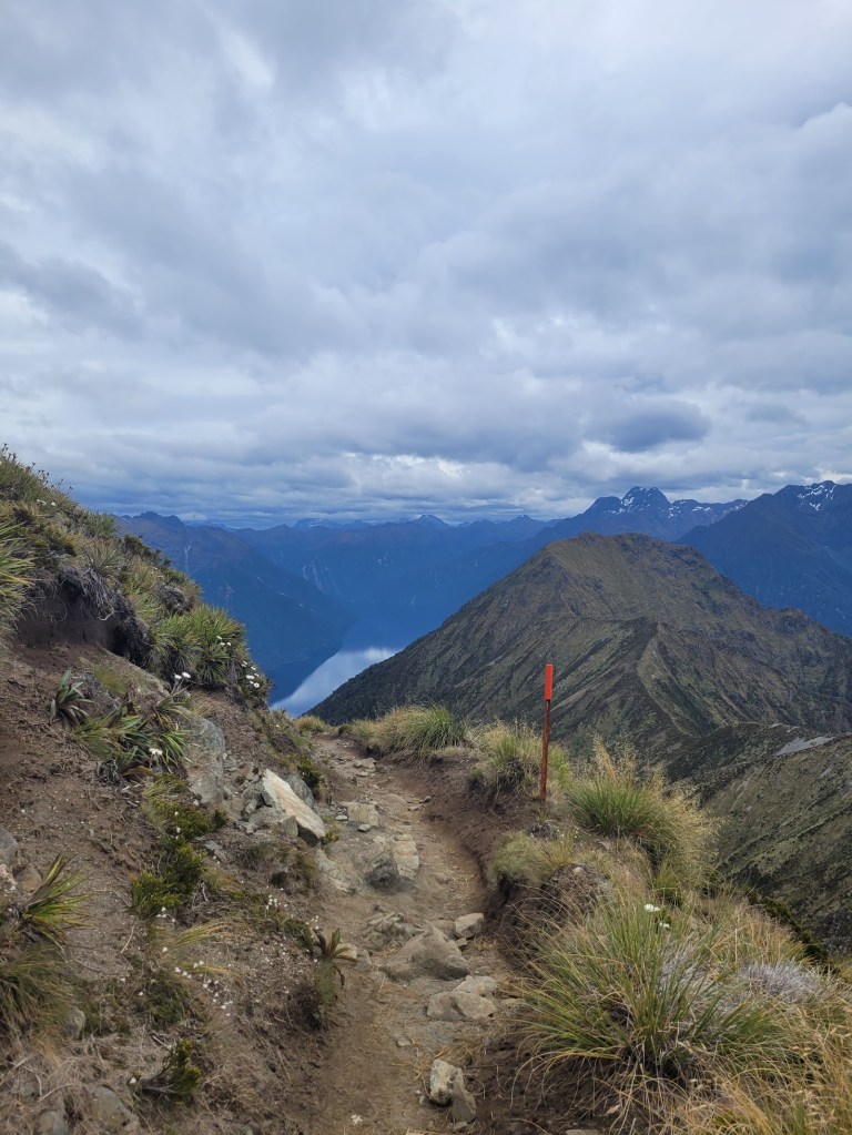
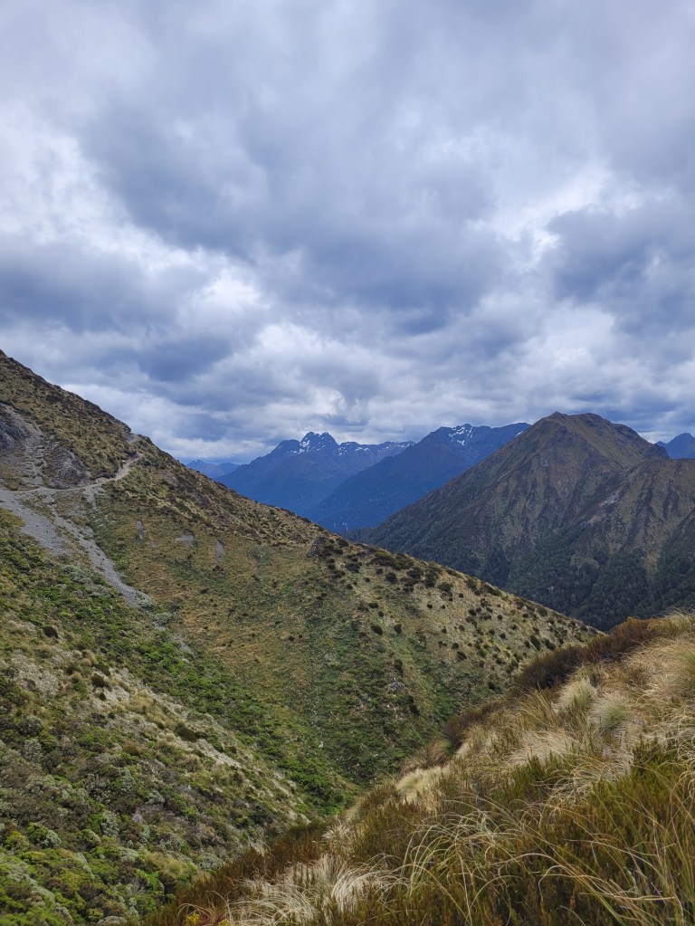
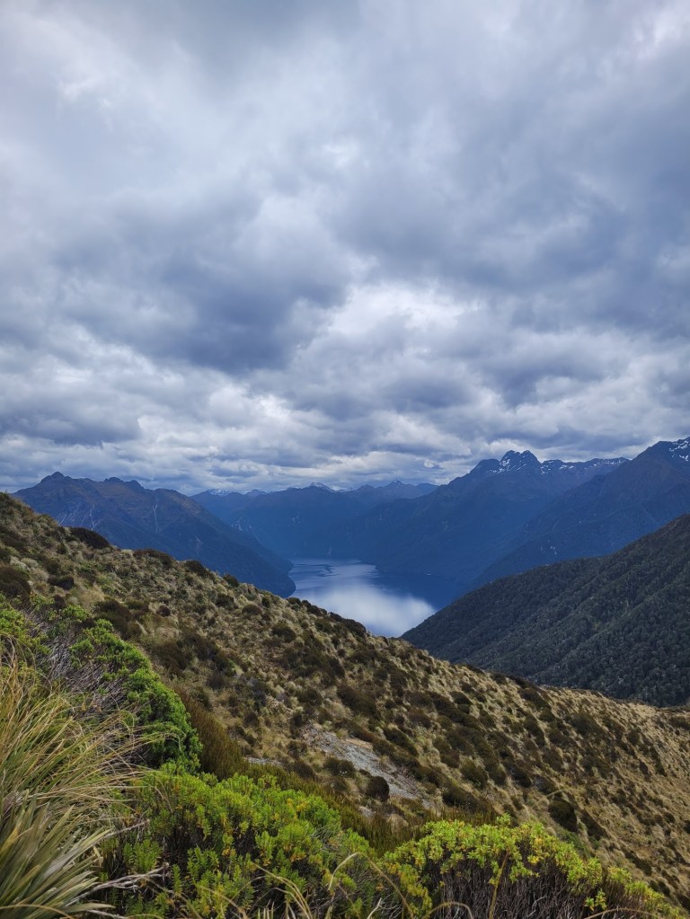
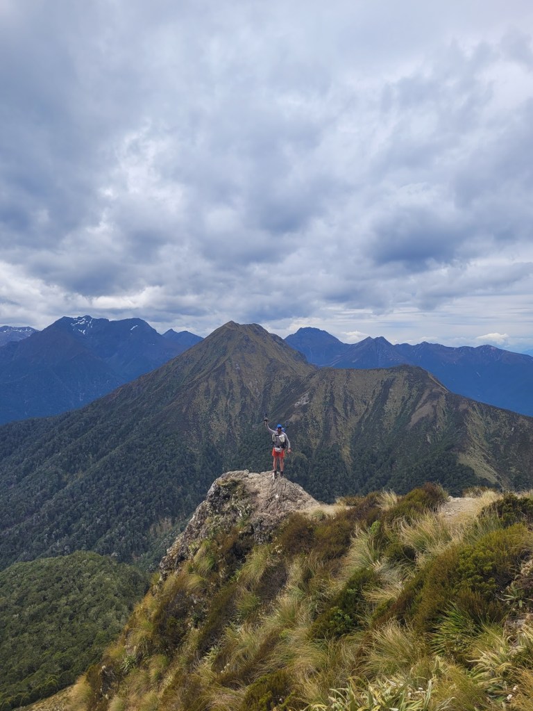
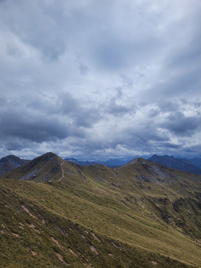
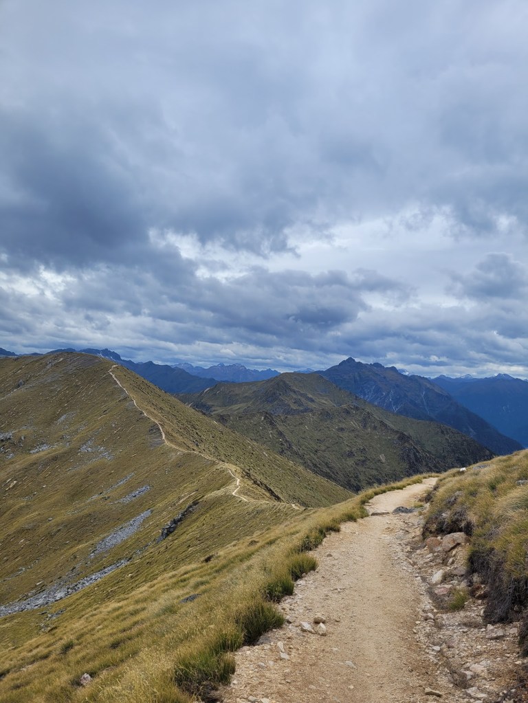
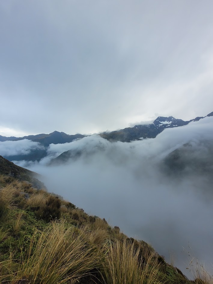
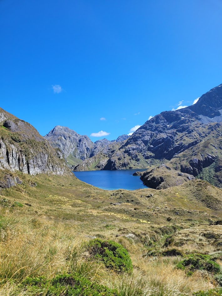
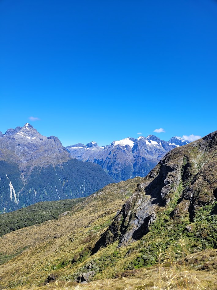
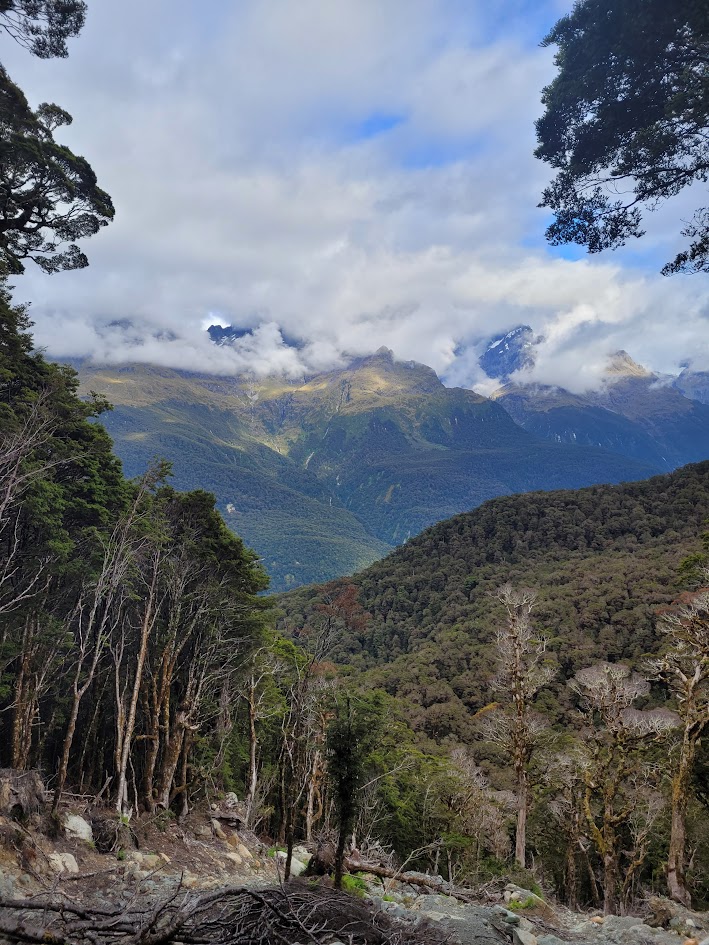
Day 2 was my favourite day on tail yet, with endless views hiking along the mountain ridgelines. What a view to wake up to!
We decided to head back to Luxmore hut for breakfast, which was a terribly ugly trip back down…
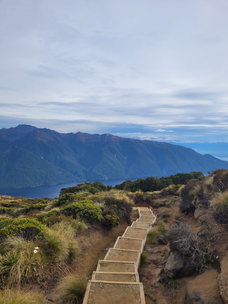
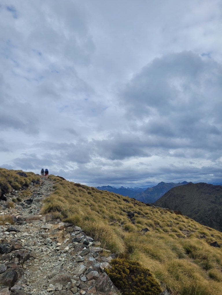
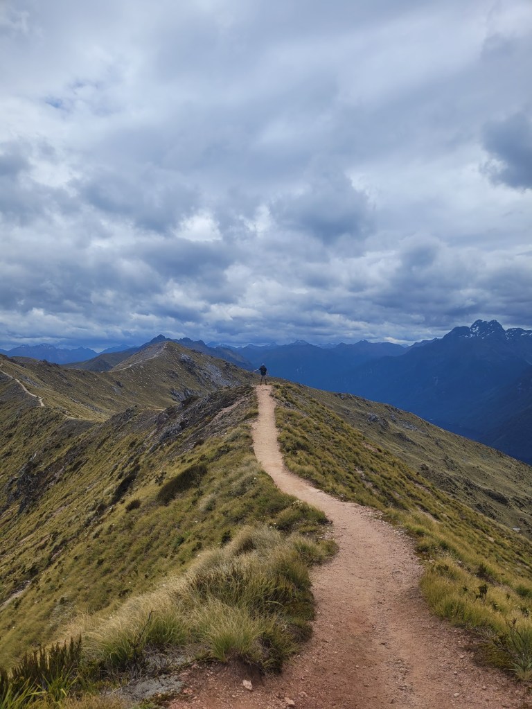
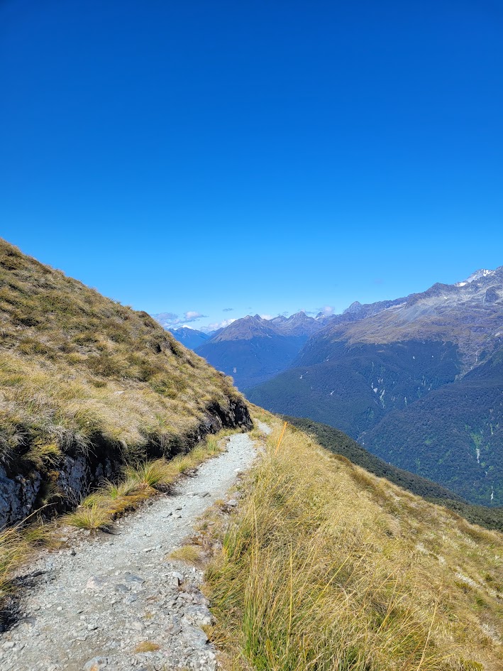
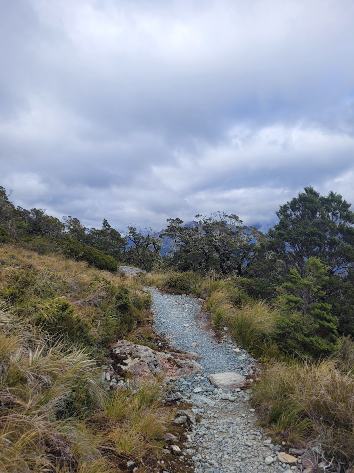
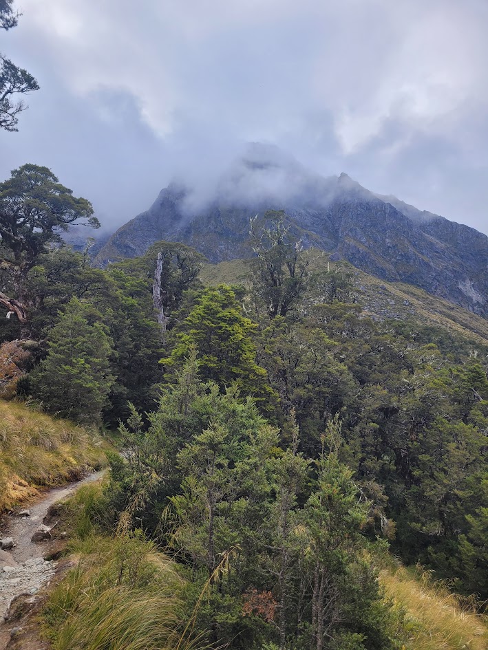
Then it was back up along the ridgelines! My FAVOURITE part of this trail. I couldn’t stop taking photos so I’m not even going to try to cull them down. Enjoy!
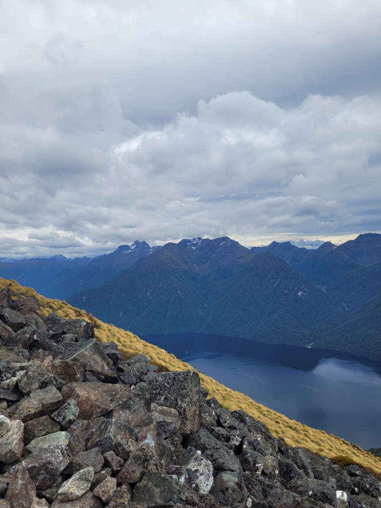
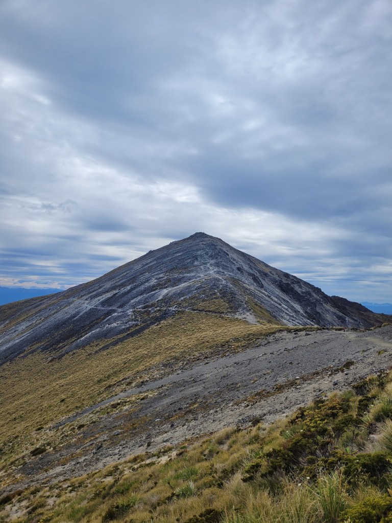
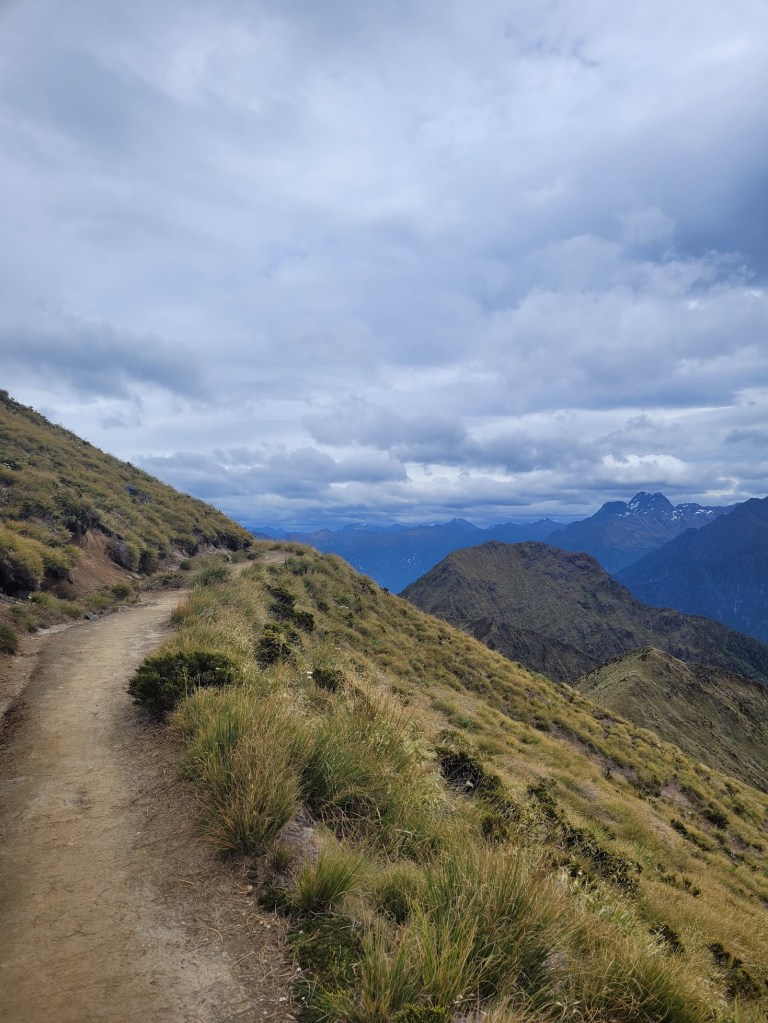
We were pretty blessed with overcast weather without the downside of rain, I don’t think this part of the track would have been as enjoyable in the harsh hot sun. Plus, overcast weather makes for the moodiest of pictures!
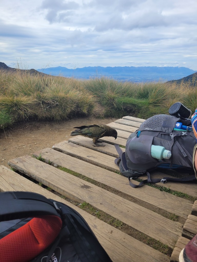
We also had our first encounter with a cheeky Kea!
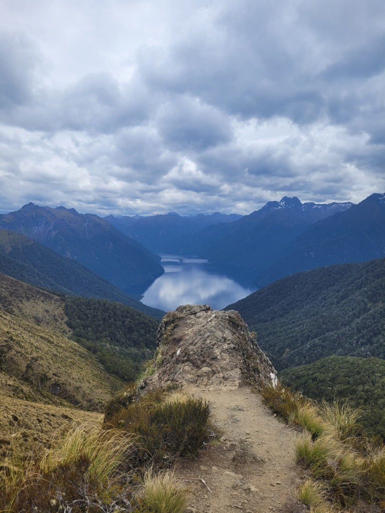
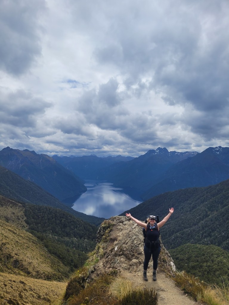
With my jelly legs and the enormous drop off, I wasn’t as game to stand on top of the rocky peak, which would have made for the most epic photo.
Mark did not have such an issue.
My favourite view of the entire hike.
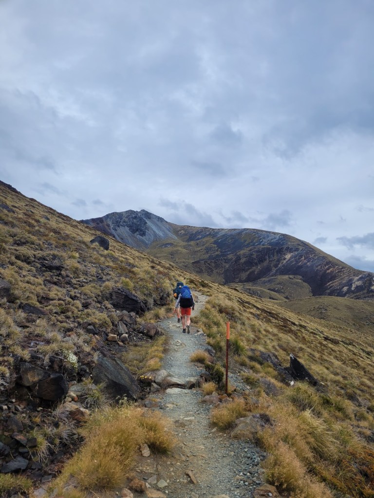
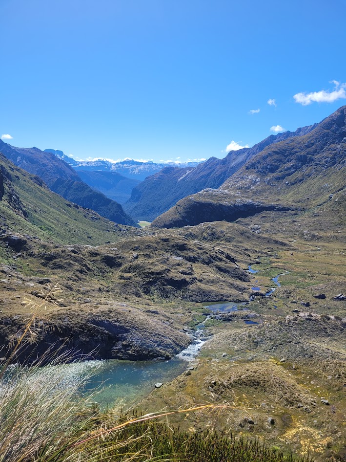
Unfortunately with high highs come low lows, and it was time to descend 900m down from the top of the mountains. I can’t remember how much switch backs it took to get down, but it was a LOT, and the knees were crying.
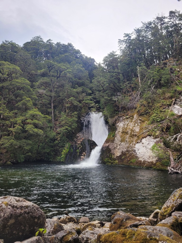
I don’t know how we had any juice left in the tank, but after setting up camp we ended up taking the side trip to check out Iris Burn Falls
Day 3
The final day on trail. This was the first day where actual rain was forecast, so we were keen to hit the track early and reach the carpark.
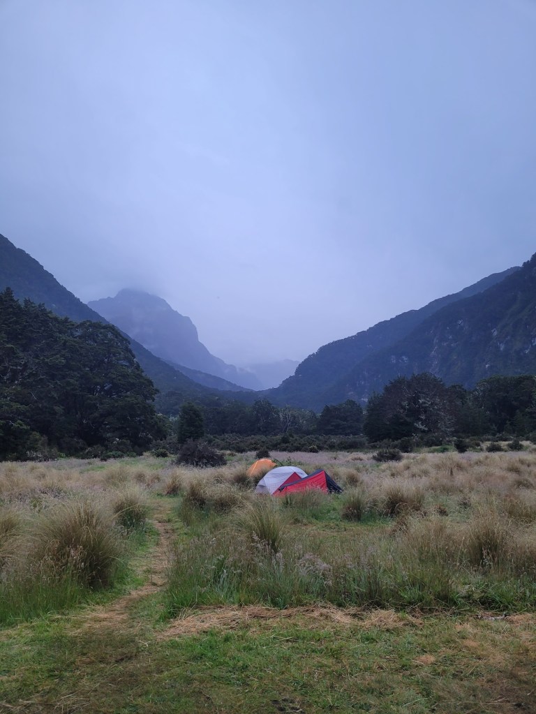
Continually epic campsite views!
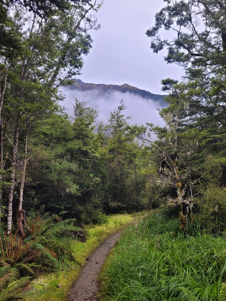
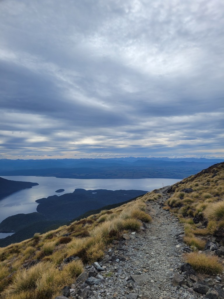
The track took us back through beautiful forest, but with a lot more mountain peaks in the background than the way in. This is a looped walk which we walked in a anti-clockwise direction, which I think is the most popular way to walk, however we did pass a few hikers walking the opposite way!
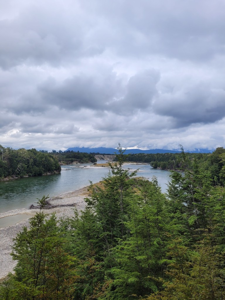
Beautiful views of Anduin River.
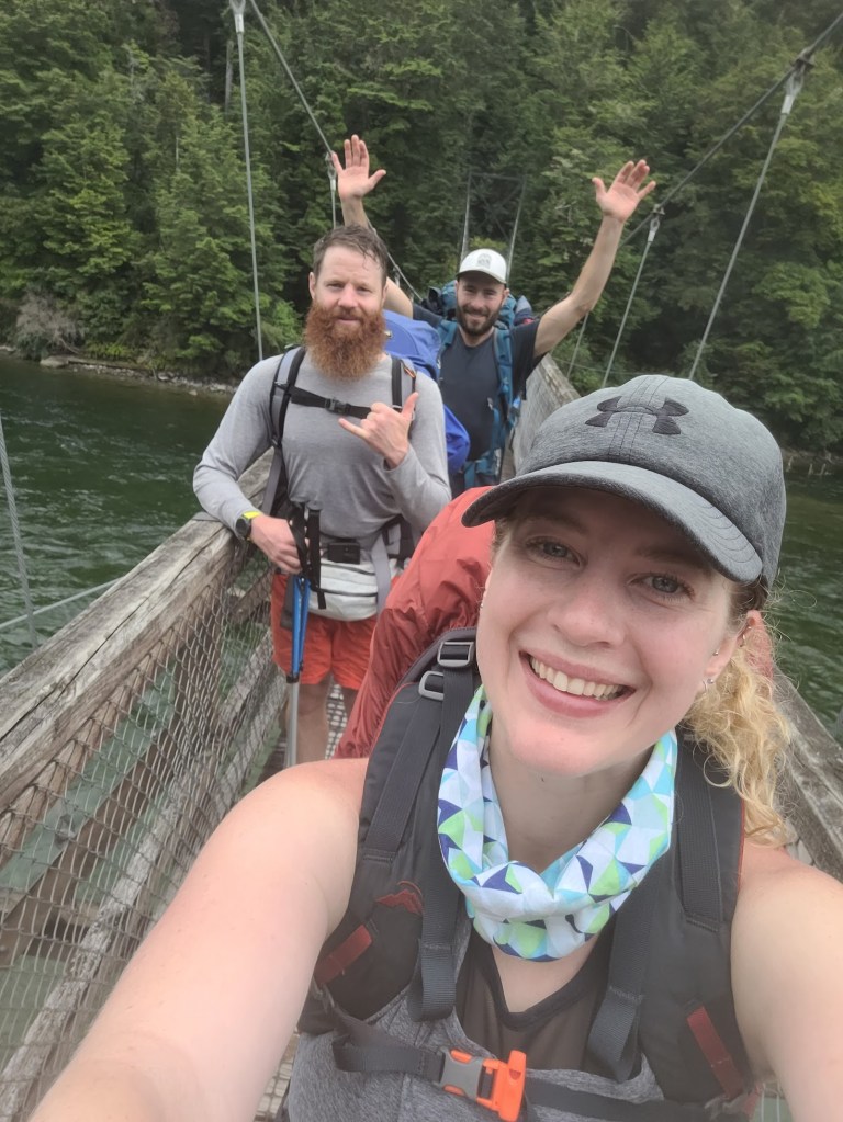
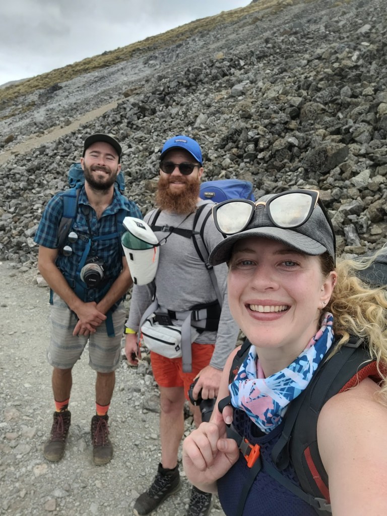
Crossing Rainbow Reach Bridge – signalling the end of our epic 3 day hike!!
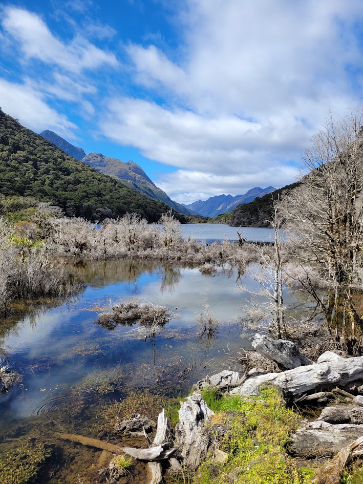
Lake Marian
We had one rest day in Queenstown after finishing the Kepler Track before we hit the road heading towards Milford Sound, so why not a quick hike to see the incredible Alpine Lake Marian!
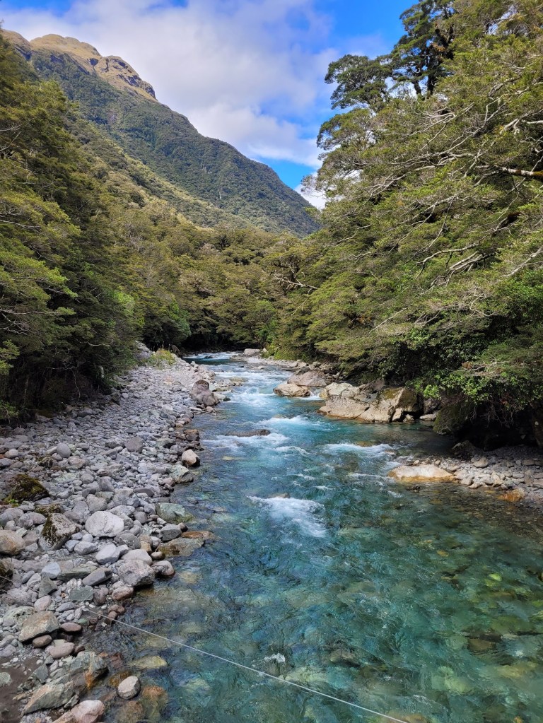
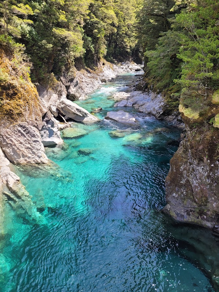
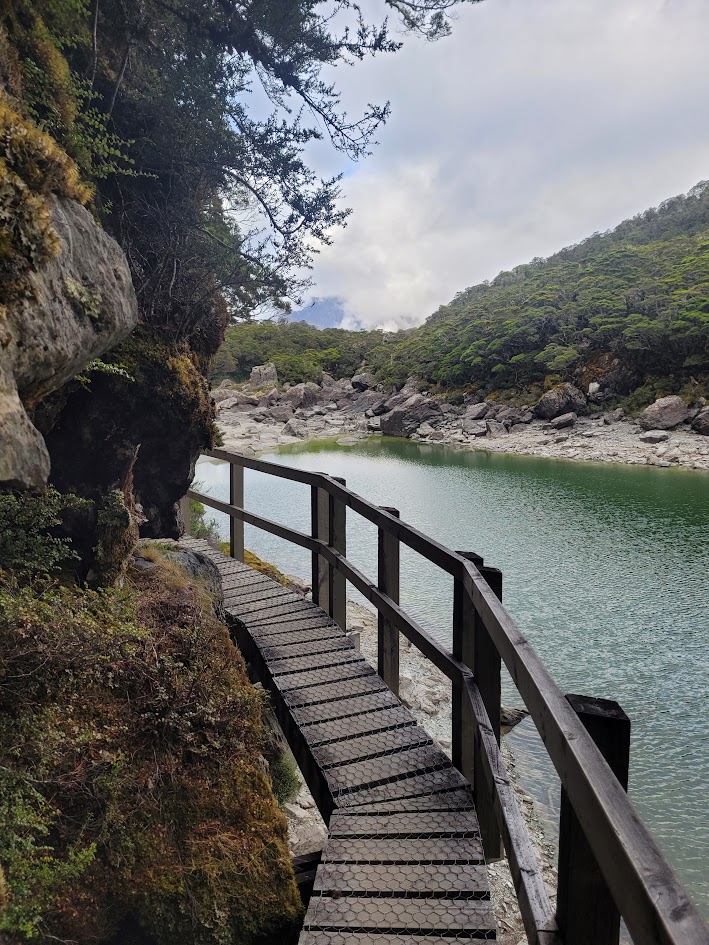
It’s a 6.3km return walk with 420m of elevation to reach Lake Marian. The track starts with a beautiful alpine river crossing. Just look at the colour of that water!
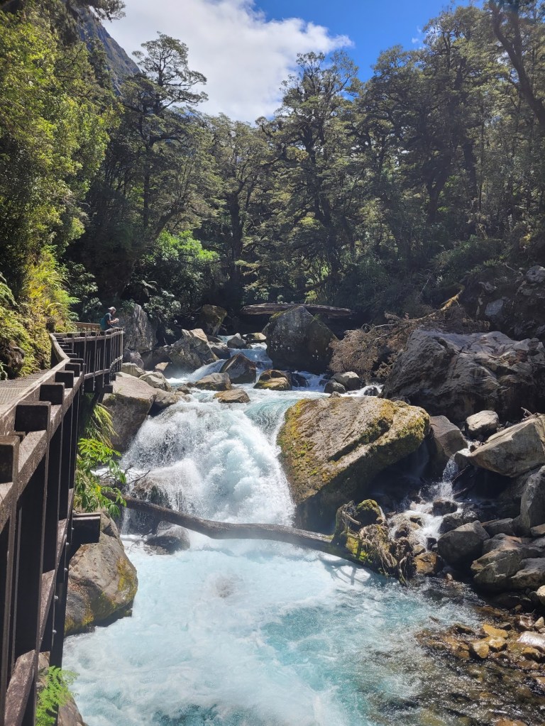
Before long you walk past Marian Falls on a very easy boardwalk. A little glimpse into the treat you’re in for on this hike!
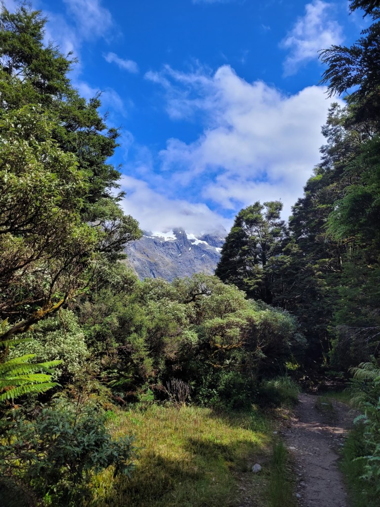
After the boardwalk past the fall there is a pretty steep and pretty rocky climb to the top. Once the track starts to flatten out you start to see glimpses of snow covered mountain peaks.
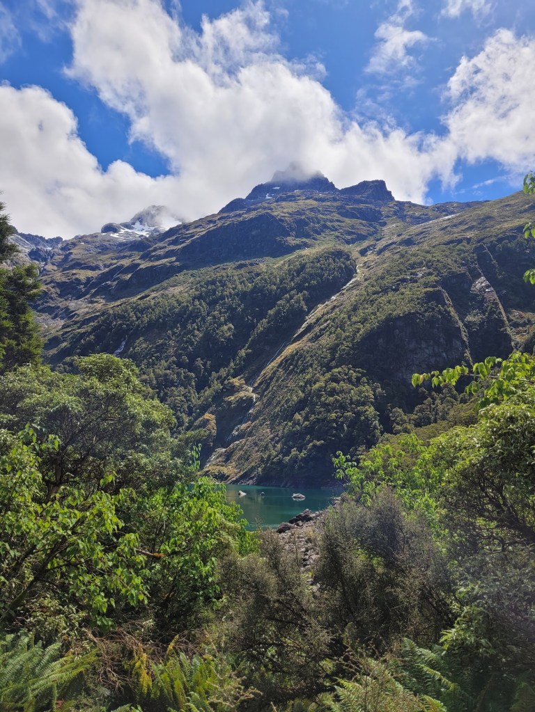
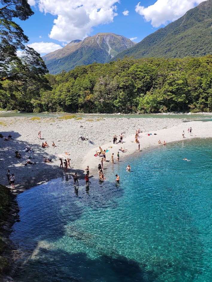
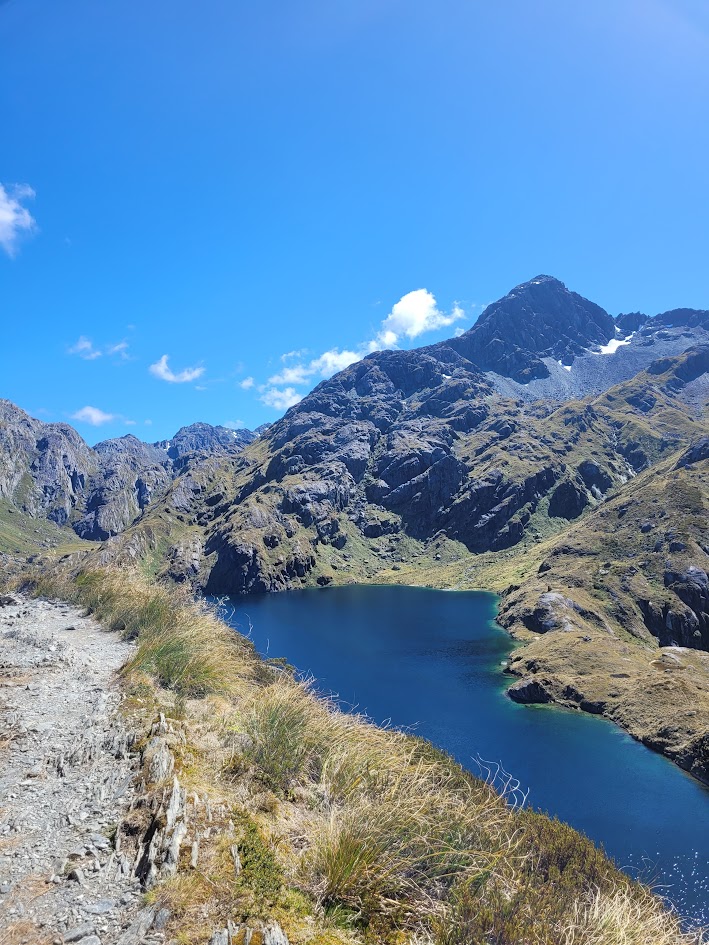
And your first glimpse of Lake Marian!
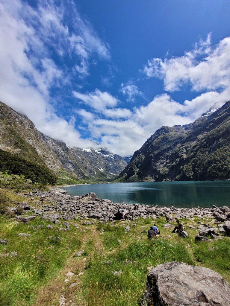
Until… you get to see THIS view:
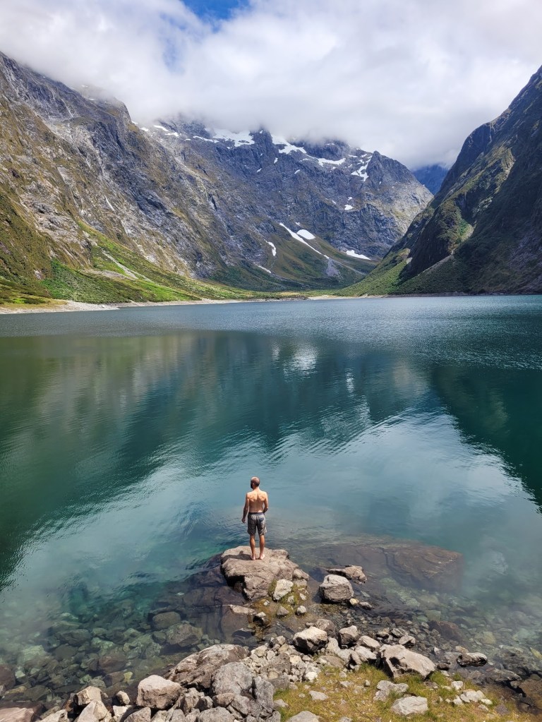
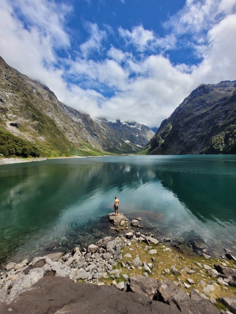
I had no idea what I was in for on this hike. I had never heard about Lake Marian before and was following a recommendation from a friend (who wanted to keep it a secret to see our reactions). It looks like we visited NZ during a bit of a dry spell, as other photos I’ve seen online have dozens if not hundreds of waterfalls flowing into the alpine lake as the snow melts!
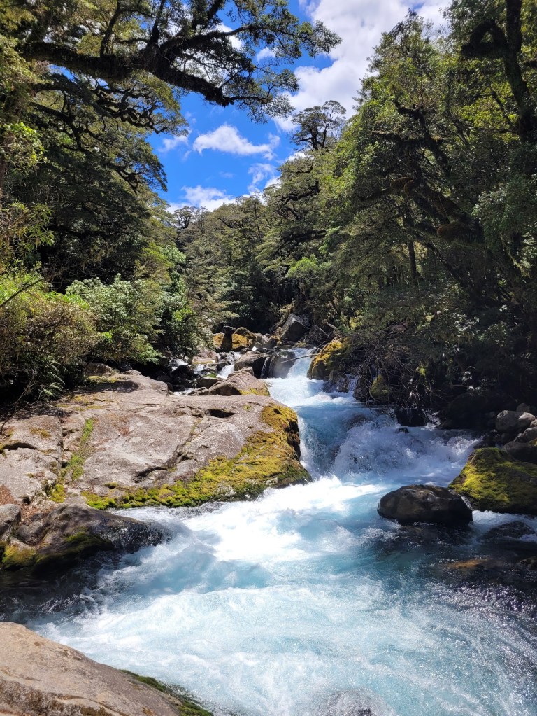
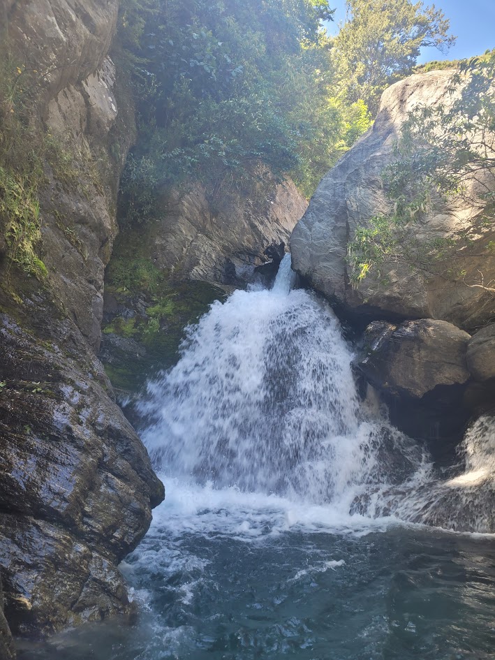
We had one last stop on the way back up the mountain from visiting Milford Sound, I can’t quite recall where it was, but the water was so crystal clear and beautiful I think its worth sharing.
I also found this photo of this beautiful waterfall in my camera roll, and can’t quite remember its location either…
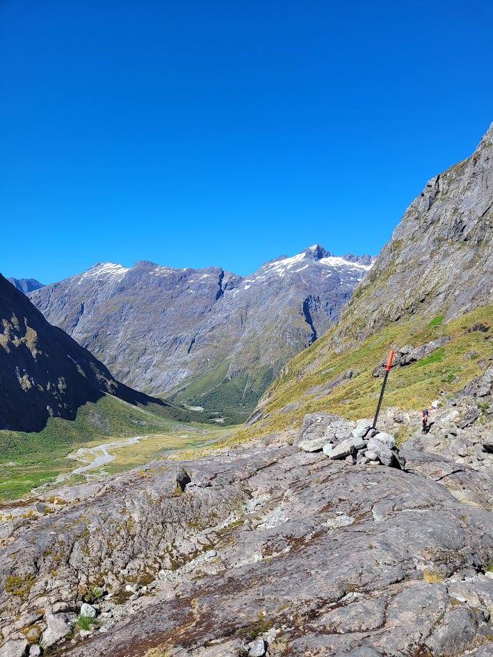
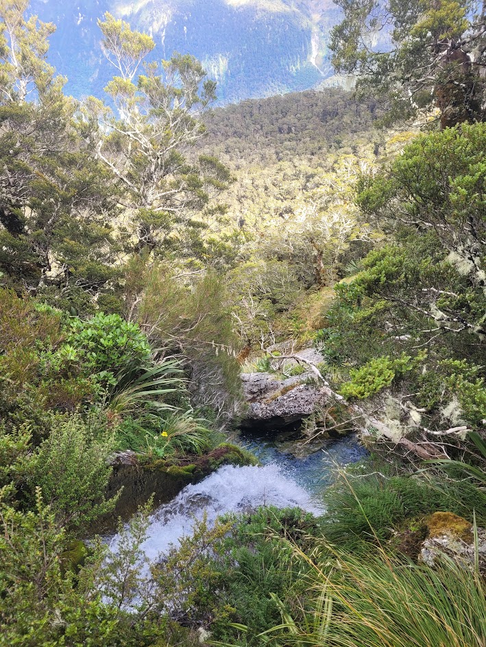
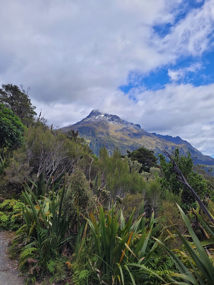
Gertrude Saddle
The next day we thought… why not head up to Gertrude Saddle?! I think by this time I was more or less running on fumes, but pretty impressed I got myself up there!
It’s a beautiful 7km return hike and very worth doing if you’re in the area, with 646m of elevation gain to get to the saddle.
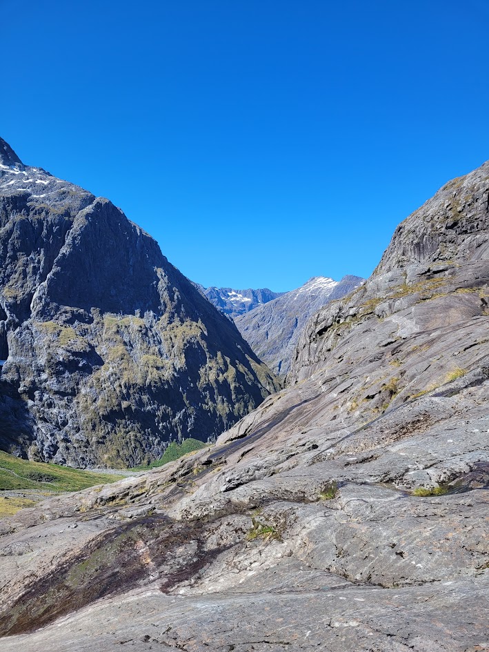
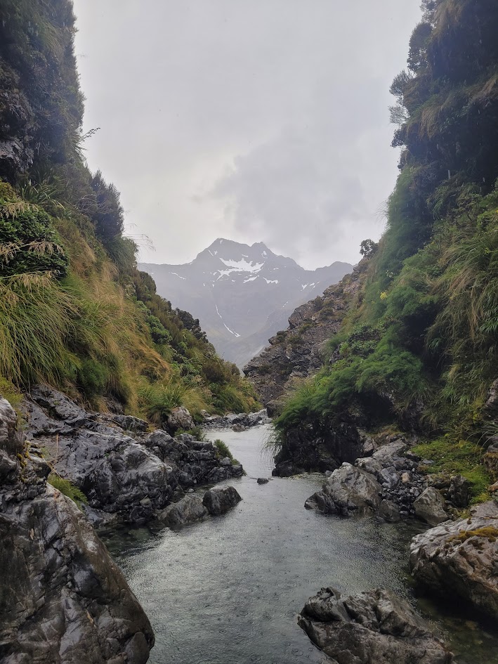
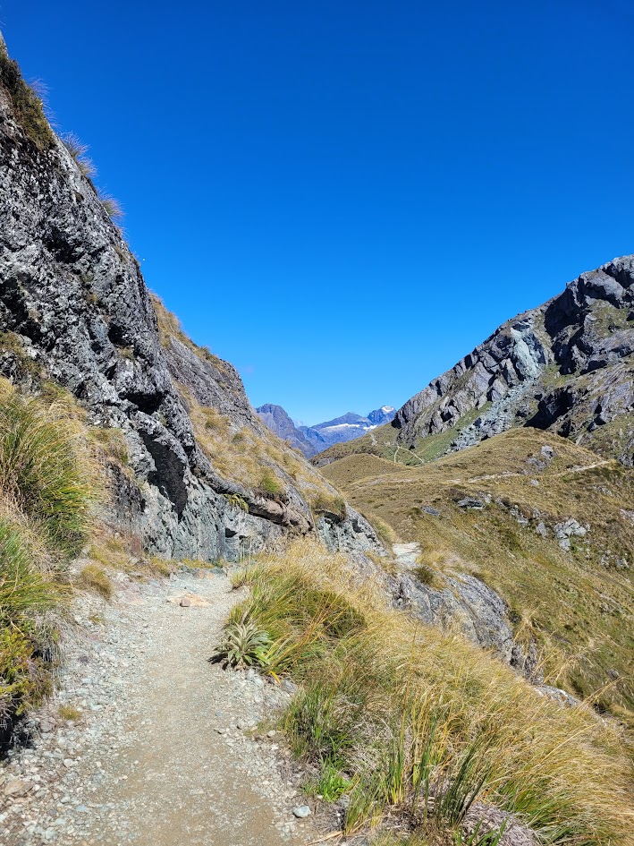
The first couple of kilometres are pretty easy flat walking along the valley, with the looming mountains surrounding you on all sides!
The track then becomes very rocky, and quite fun, before reaching Blake Lake, which feels a bit like its meant to be the destination, but the saddle is even further!
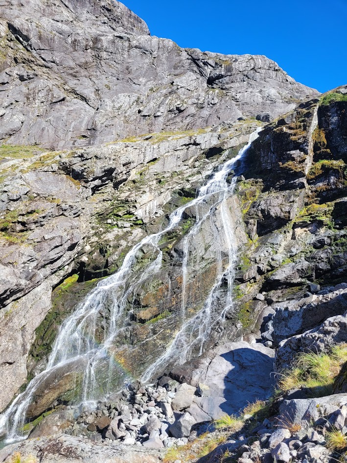
There is a creek with waterfalls that flows straight out of Black Lake down into the valley, I’m not entirely sure what the name of the creek is, but it means you get to be hiking up next to waterfalls in this section of the hike.
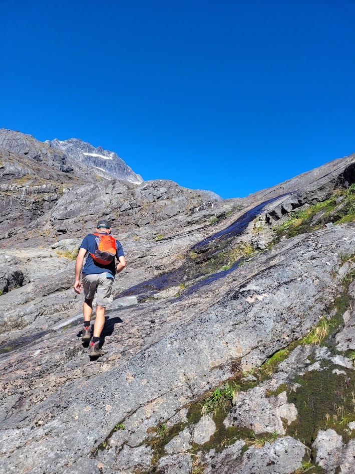
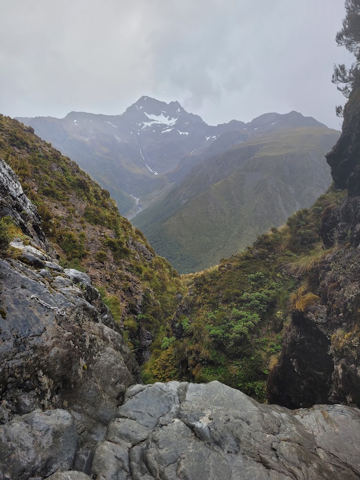
All the elevation gain of the hike is all right at the end! I was feeling pretty exhausted from the last few days, but still felt guilty seeing people flying up with kids strapped on their back. I guess they didn’t just finish 4 days of hiking prior!
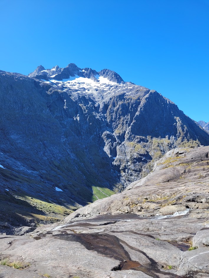
The views as you climb up are epic. I also didn’t realise this at the time, but on the other side of the mountain peak pictured above is Lake Marian where we were the day before!
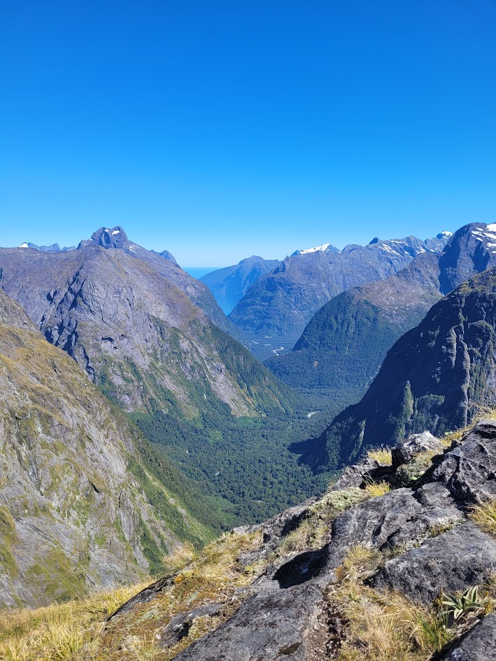
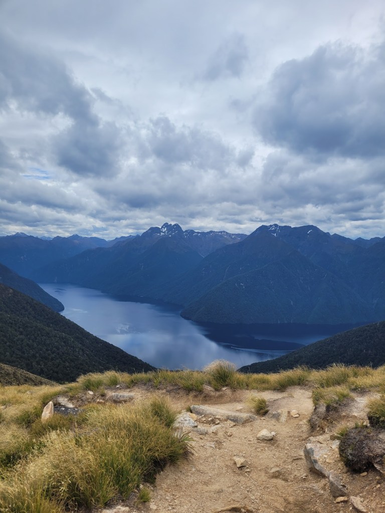
Finally up on the saddle! With views all the way through to Milford Sound.
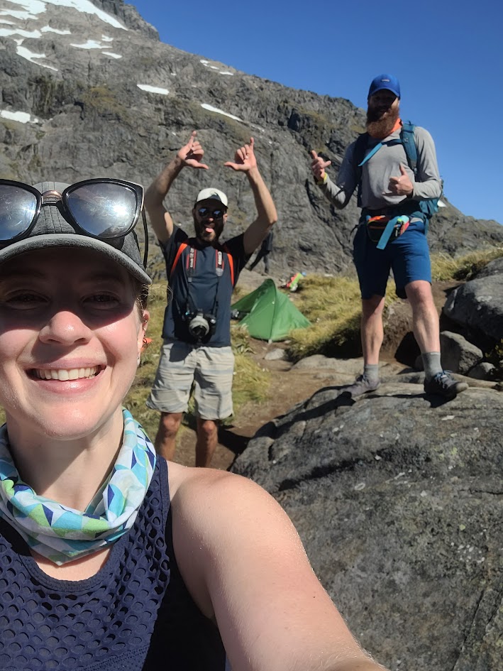
Happy chappys.
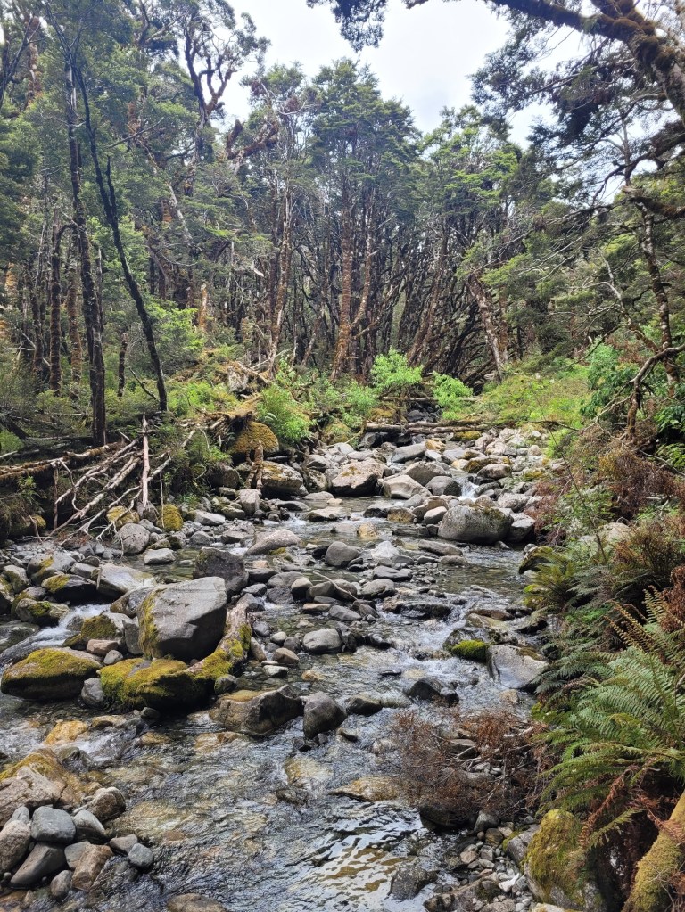
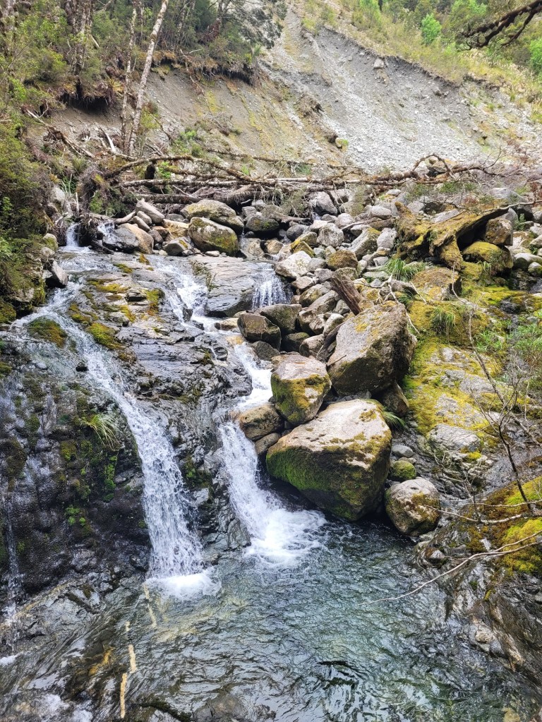
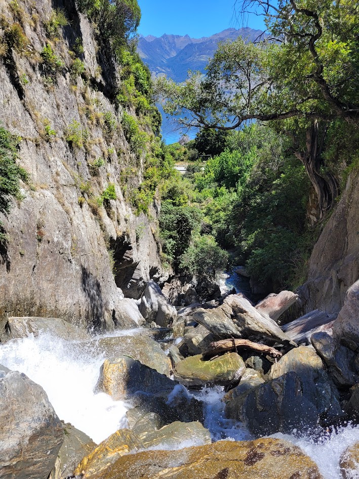
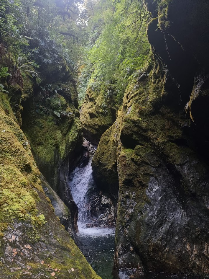
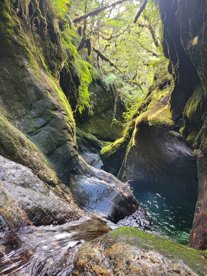
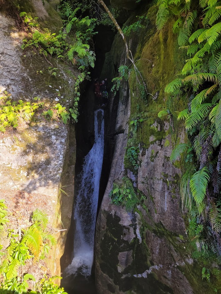
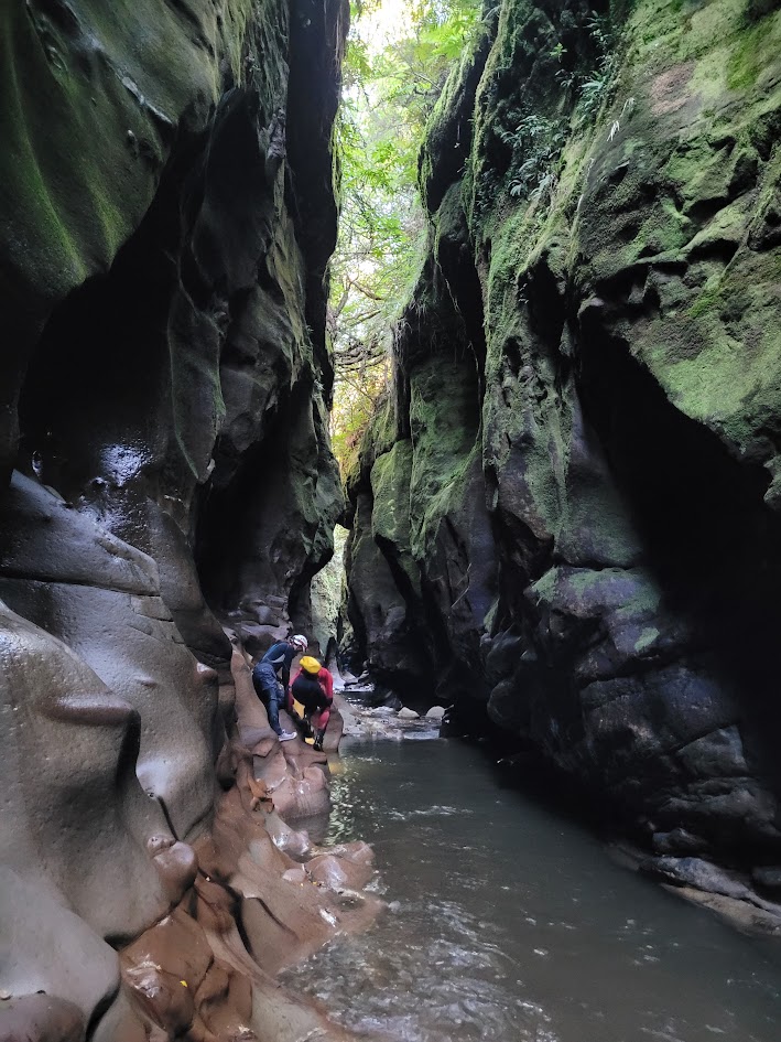
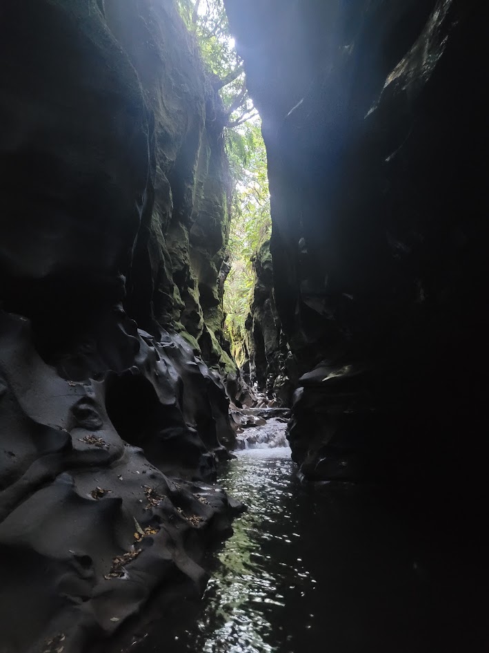
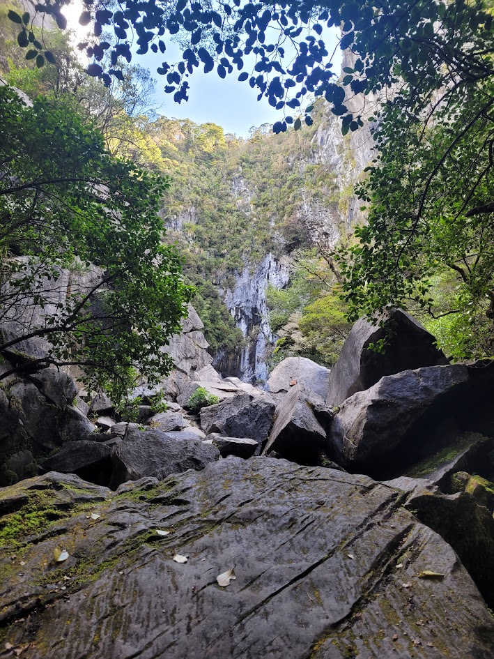
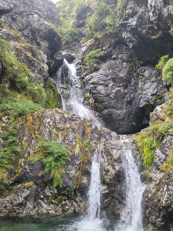
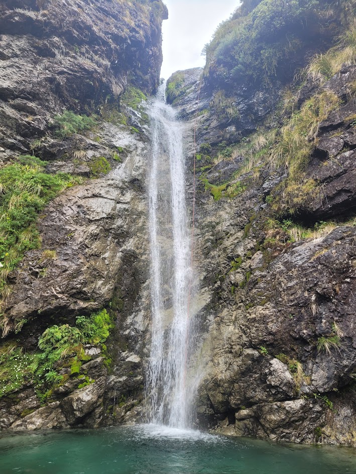
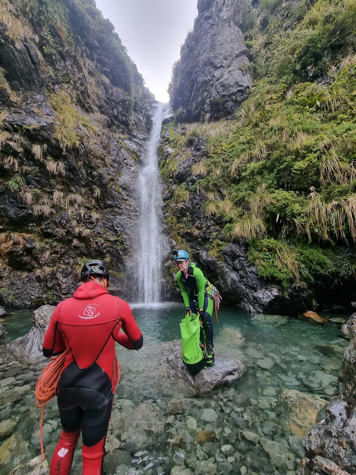
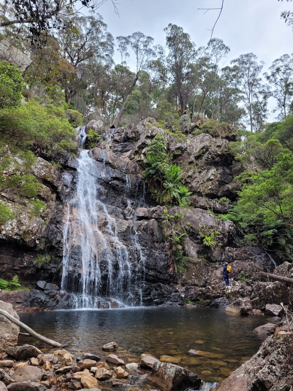
Camp Creek Canyon
The following day, it was finally time for our first New Zealand Canyon! On the way to Haast Pass, we decided to stop by for a trip through Camp Creek Canyon.
This was our first time experiencing a hike to get to the start of the canyon, with a cruisy flat walk to the cars afterwards. Compared to Blue Mountains canyons, this was SUCH a treat.
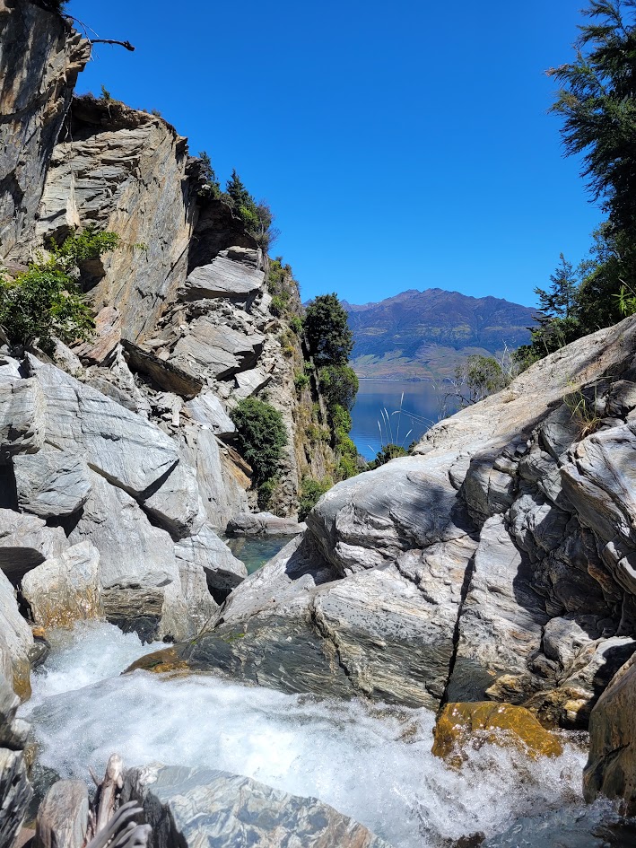
With stunning views the whole way down. Its not a long canyon, but one thing we didn’t realise is there was recently a huge landslide through the canyon which completely changed the nature of the abseils. We had been following the guidebook, so didn’t get the updated memo which was online. Once we checked the online canyoning website (after finishing the canyon) we found it was advised not safe to do…
I did remember being quite confused on the day, as I had screenshots of the canyon guidebook for the abseils and trip report. From the guidebook photos they were meant to be quite flat rock drops (if that makes sense) whereas what we were abseiling was a rocky, caverny, complex boulder field with waterfalls.
And then the cruisy flat walk back to where we had parked! I think it was time for a rest day.
Blue Pools
This was our ‘rest day’ which included a short hike to the stunning Blue Pools, a very popular swimming and bridge jumping spot.
Just look at the colour of that water!
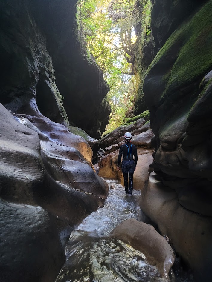
Cross Creek Canyon
The boys had actually done a quick trip through Cross Creek Canyon the day before, after we visited Blue Pools. I had to sit this one out as I knew I needed rest, but it was quite funny sending them off on their way, they were so packed and ready it felt like the first day of school!
I asked if they minded doing the canyon a second time the next day so I could join, to which they had no problem, so alas here they go again!
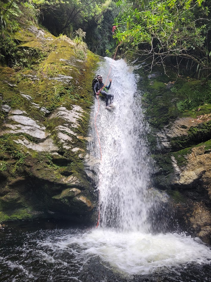
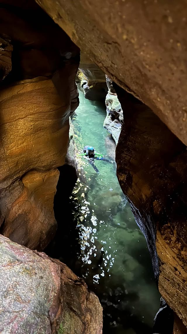
This was our proper first taste of a Haast Pass New Zealand Canyon, and we LOVED it.
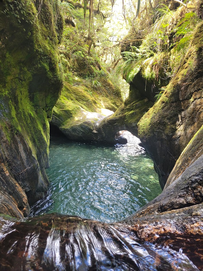
Archways and waterfalls in a canyon? YES please!
And before long… it was the shortest and cruisiest hike back to the van I had ever experienced. What a dream.
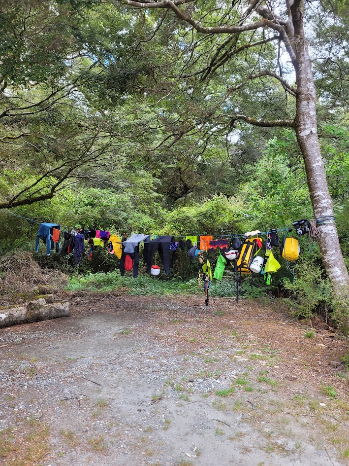
After each canyon we were meticulous about washing our gear to stop the spread of Didymo, so each camp in the evening looked a little like this.
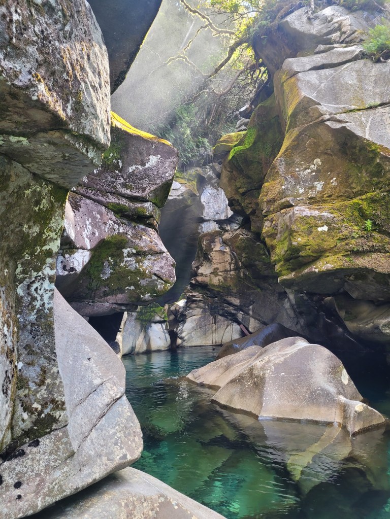
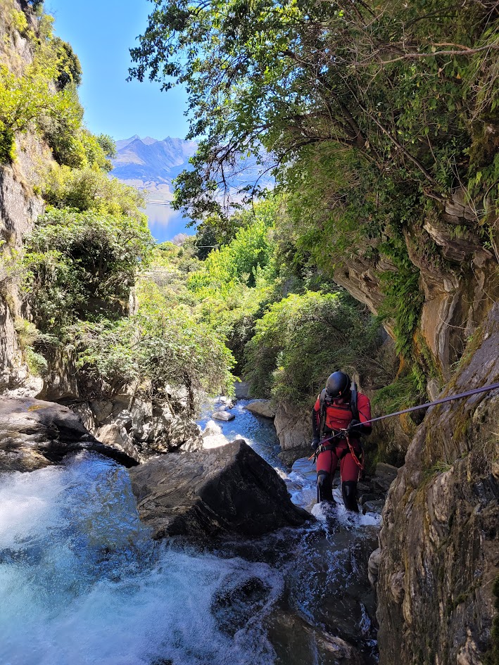
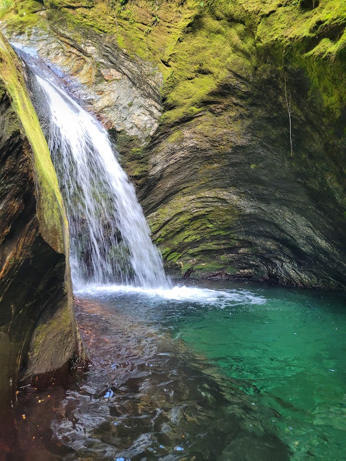
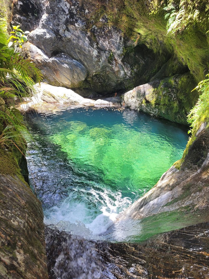
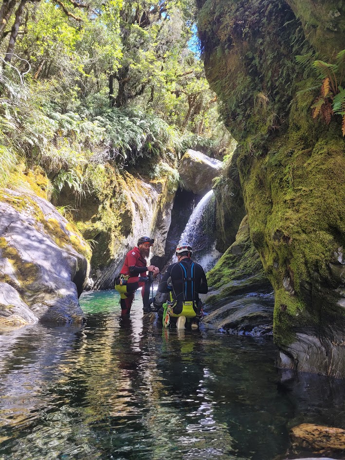
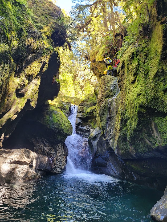
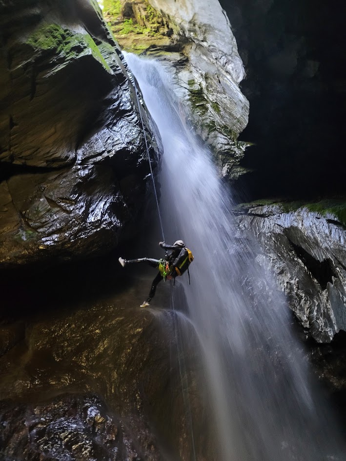
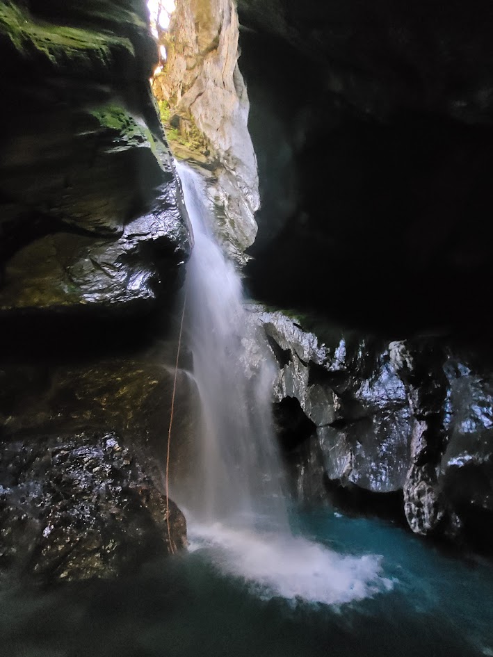
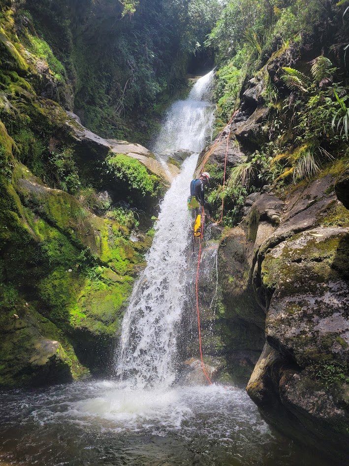
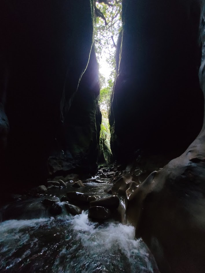
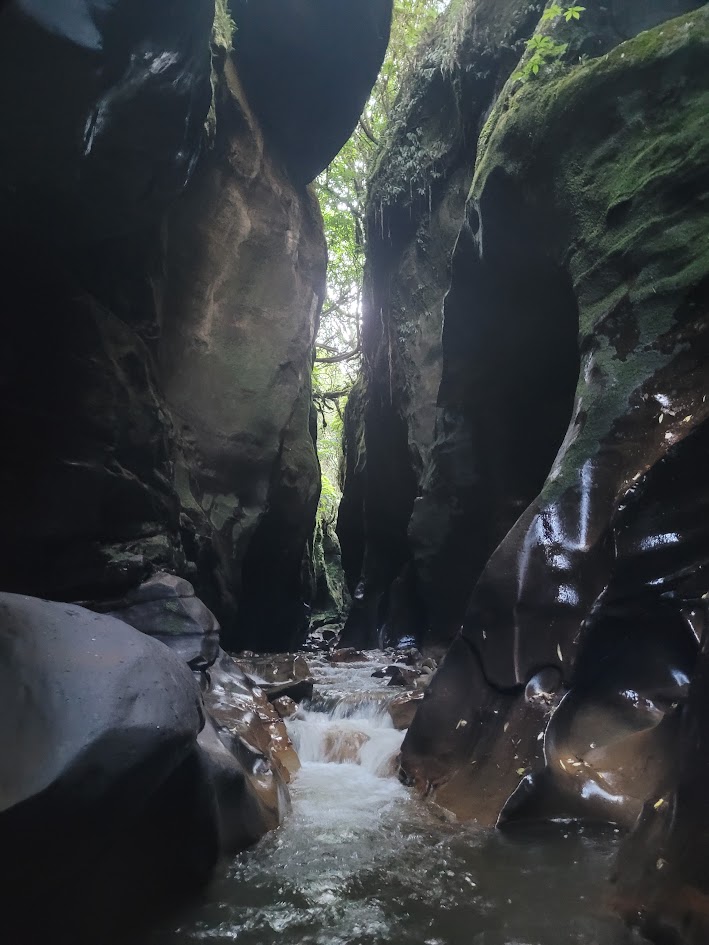
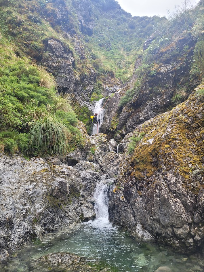
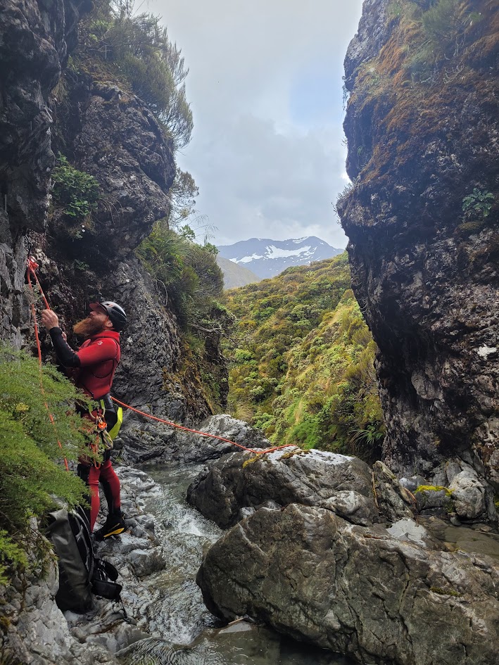
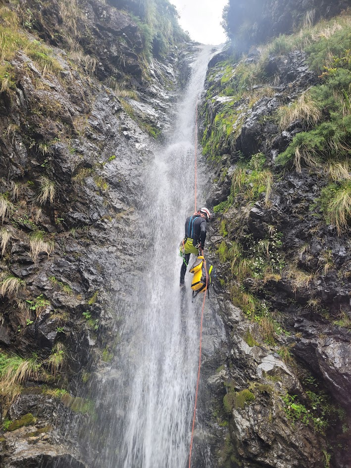
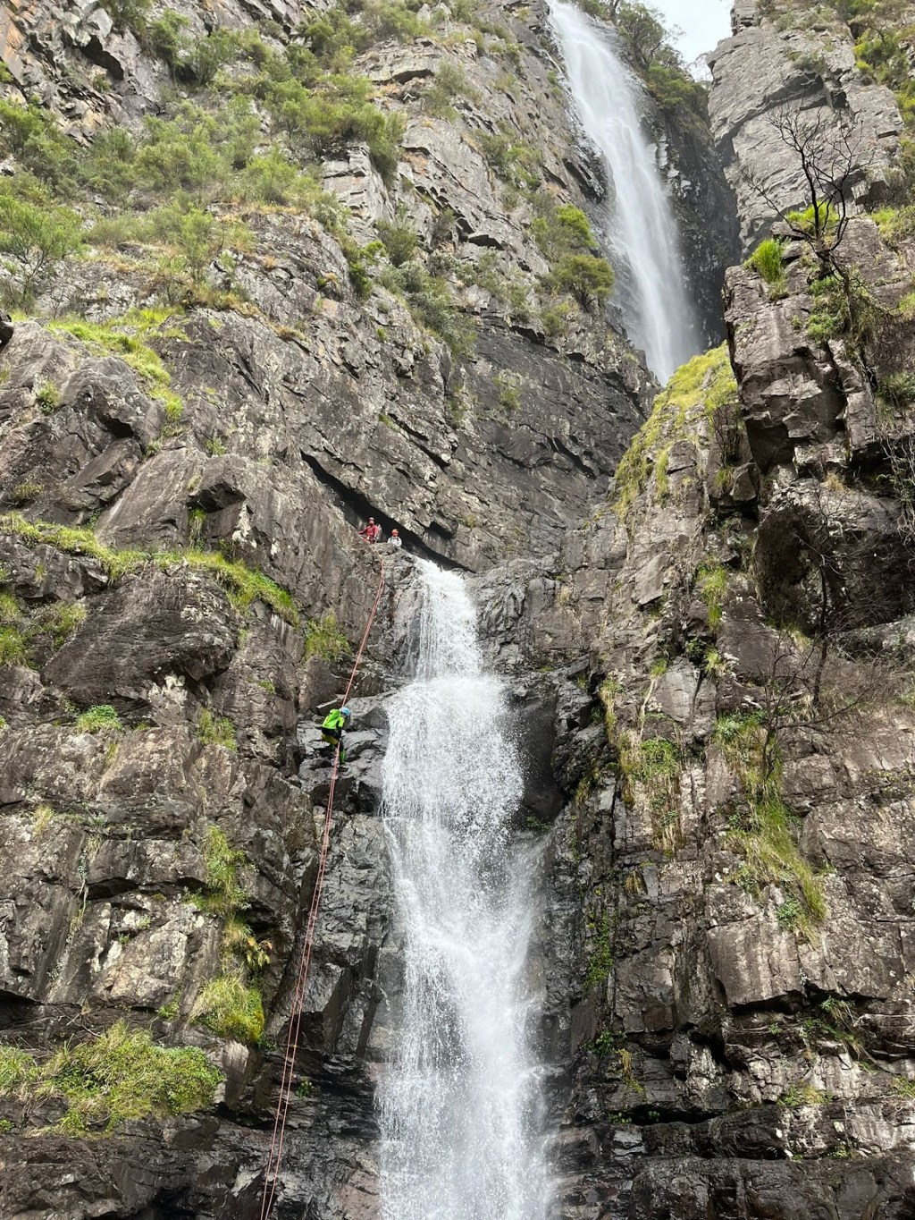
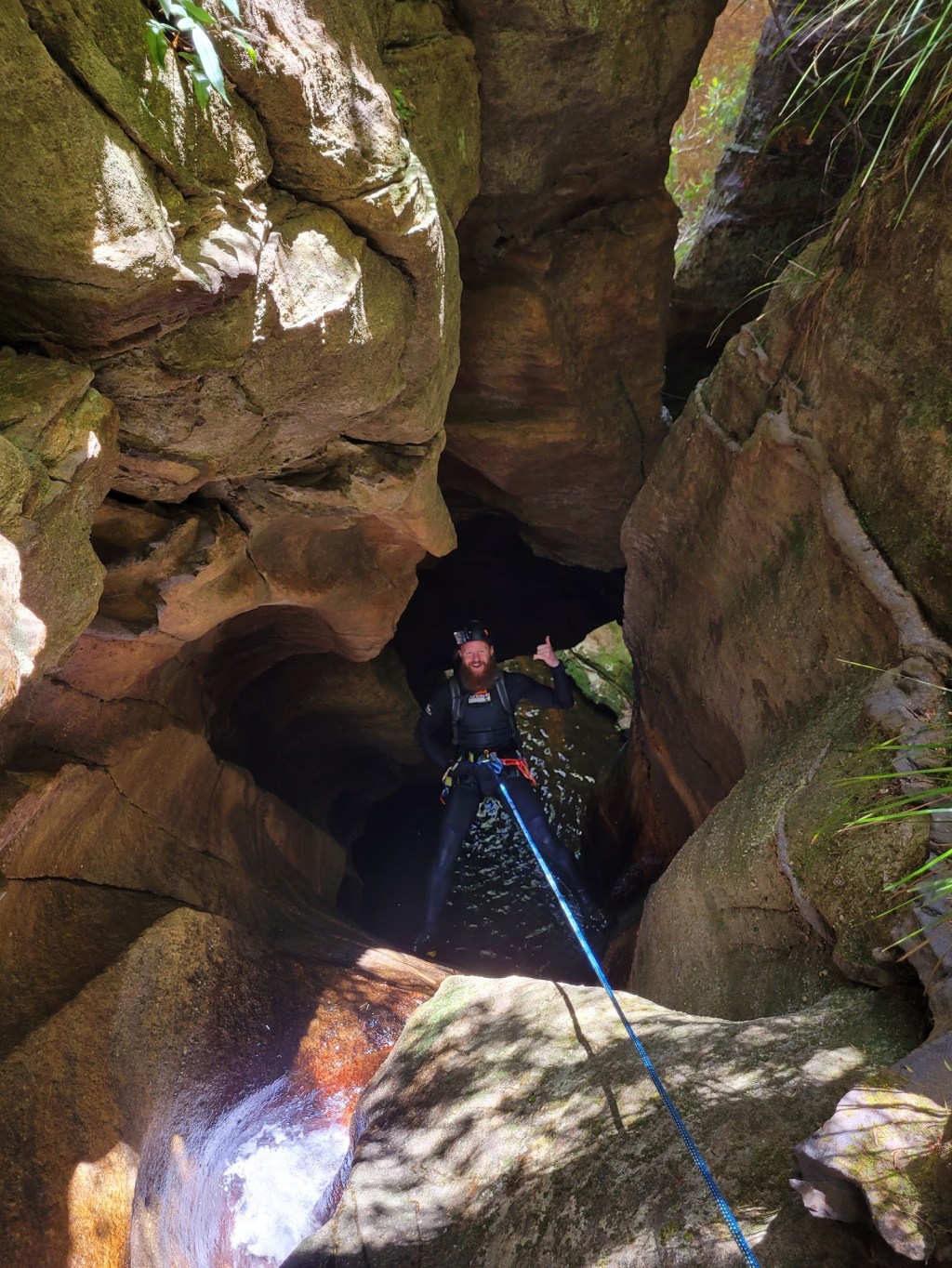
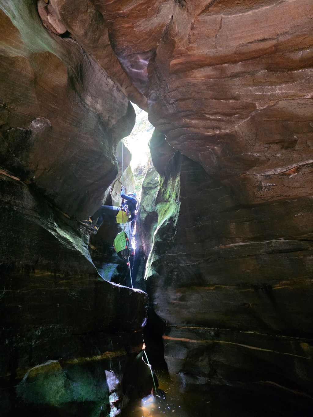
Robinson Creek Canyon
The very next day we did a trip through Robinson Creek Canyon, which was even better than Cross Creek the day before.
In the carpark for the canyon we bumped into the legendary Alain Rohr, who was getting ready to guide a small group through. We couldn’t help but speak with him and ask him to sign our canyoning books, after all, Alain had founded and carried out many first descent of canyons in New Zealand, including the ones we were doing in Haast Pass.
It was so fascinating to show him our canyoning books, he said he didn’t own one himself, but as he flicked through its pages he pointed out almost every second photograph was one he or his former partner had taken. You could see all the memories flooding in. Getting the background stories behind some of the canyons and photographs was invaluable, especially hearing about the near misses and long days. Its such a joy to see him still out there canyoning and guiding, he would have to be well into his 60s or 70s now.
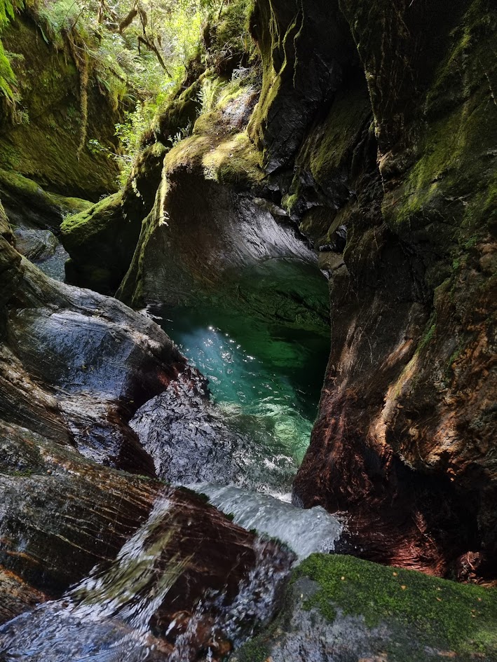
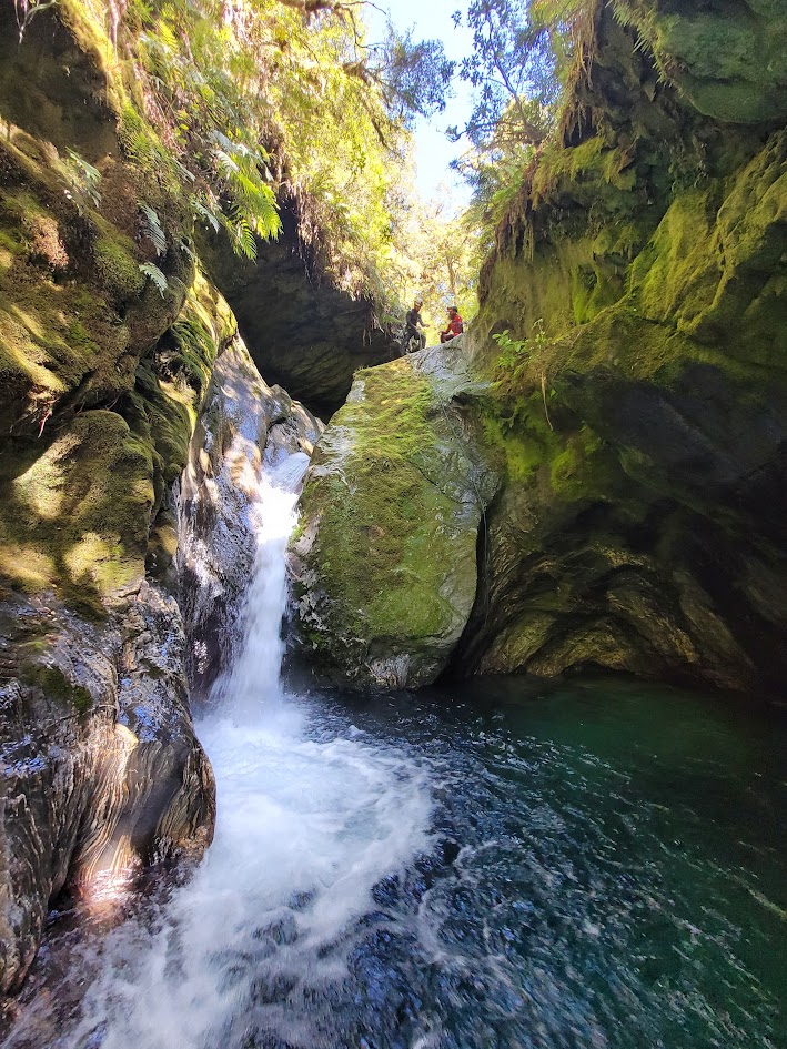
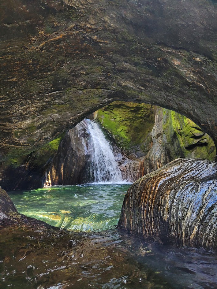
Robinson Creek is a glorious canyon.
On one of these abseils we got one of our ropes stuck, we tried everything to pull it down and weren’t in a spot where we could climb back up to retrieve it. Luckily, Alain and his group had come up behind us and unstuck the rope for us.
We had left the figure 8 on the end of the rope, thinking the pull was clear from any obstacles and wouldn’t get stuck. Against all odds, the large hole of the figure 8 had somehow landed on a bolt in the rock. Was NO way we were getting that down by pulling!
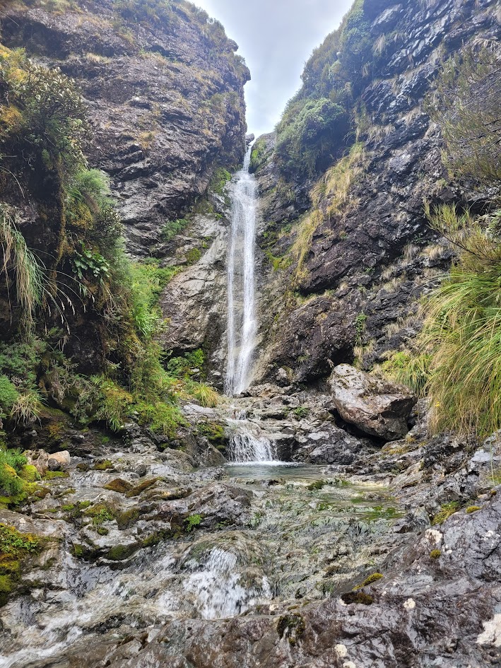
The best part of this canyon, the huge cavern and waterfall at the end!
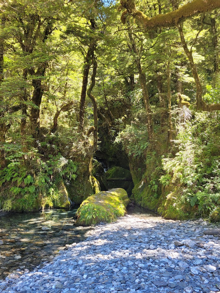
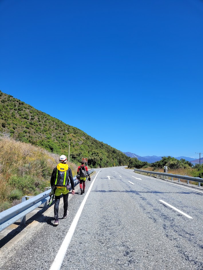
And shortly after the canyon ends! This photo is taken from the canyon carpark. That is how close the exit is!
The guys then wanted to go through Imp Grotto, but again I knew I needed rest, so I sat this one out, specifically, I sat at the exit and waited to see them drop out! Hopefully I can do the canyon another time.
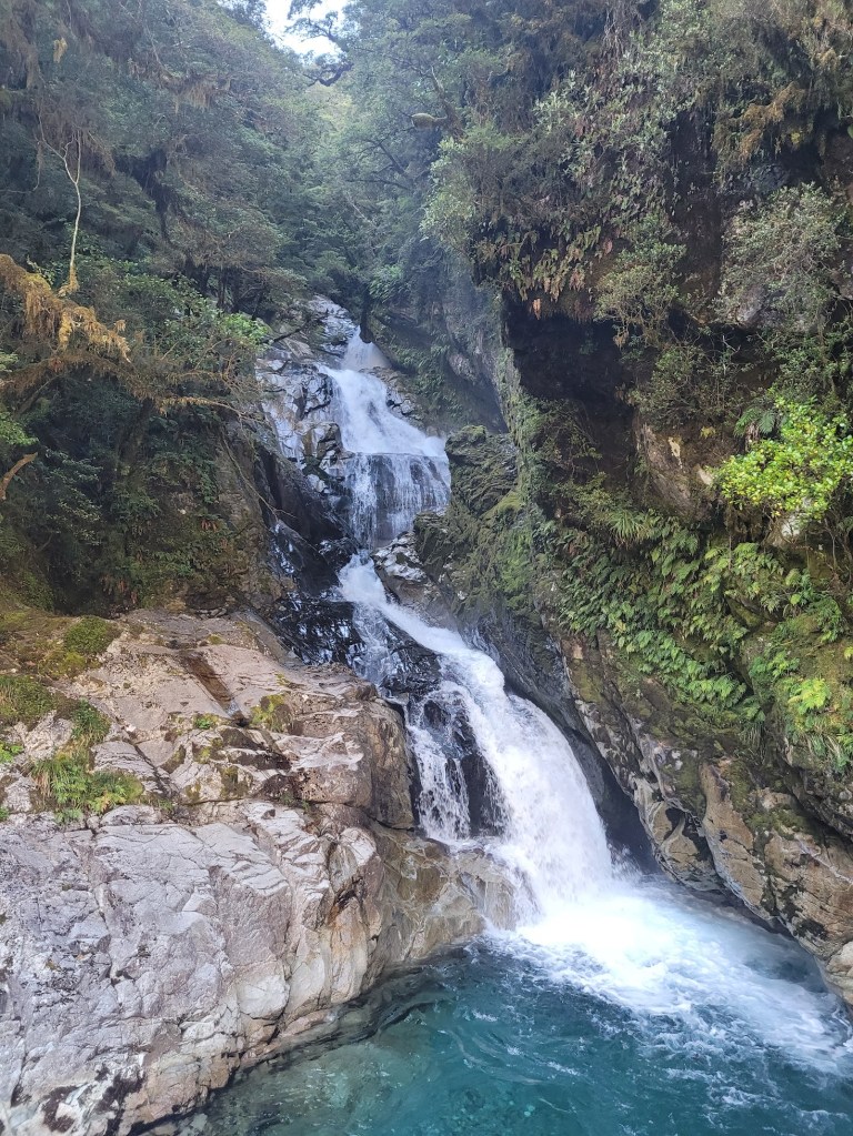
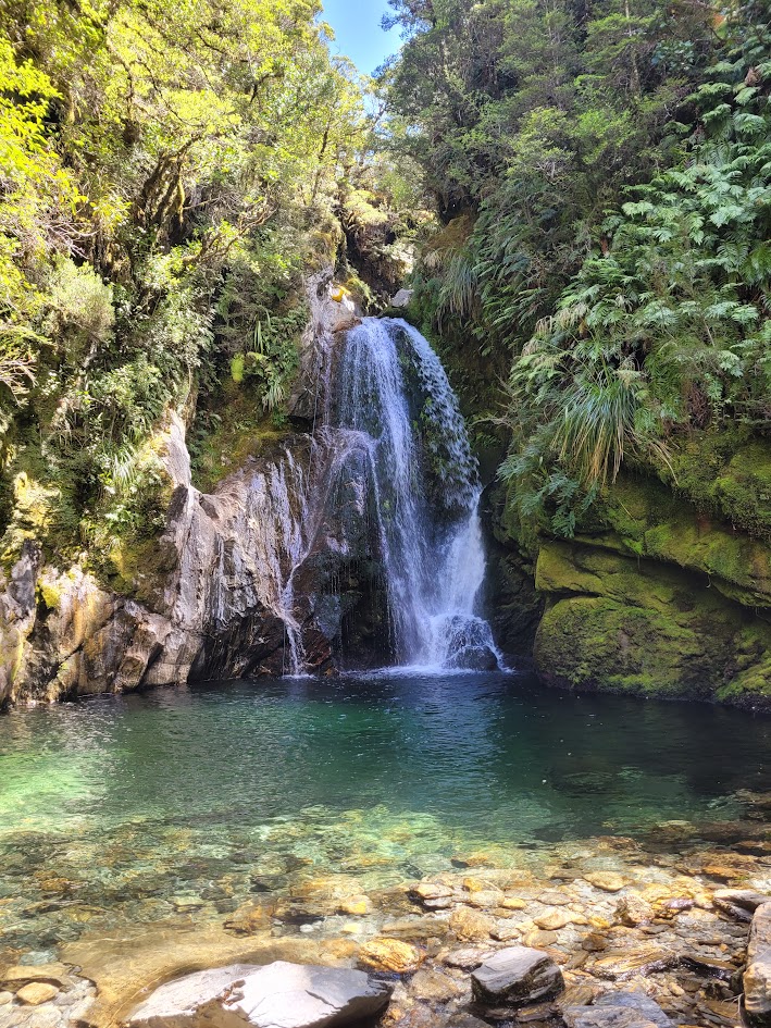
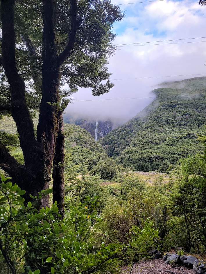
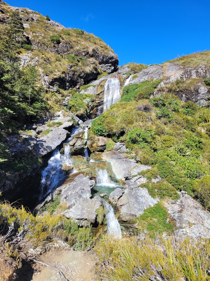
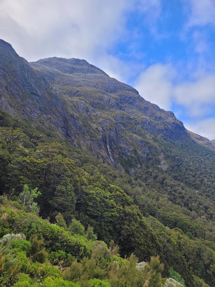
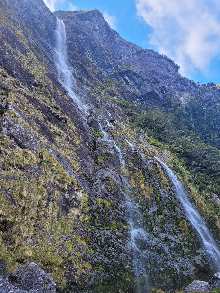
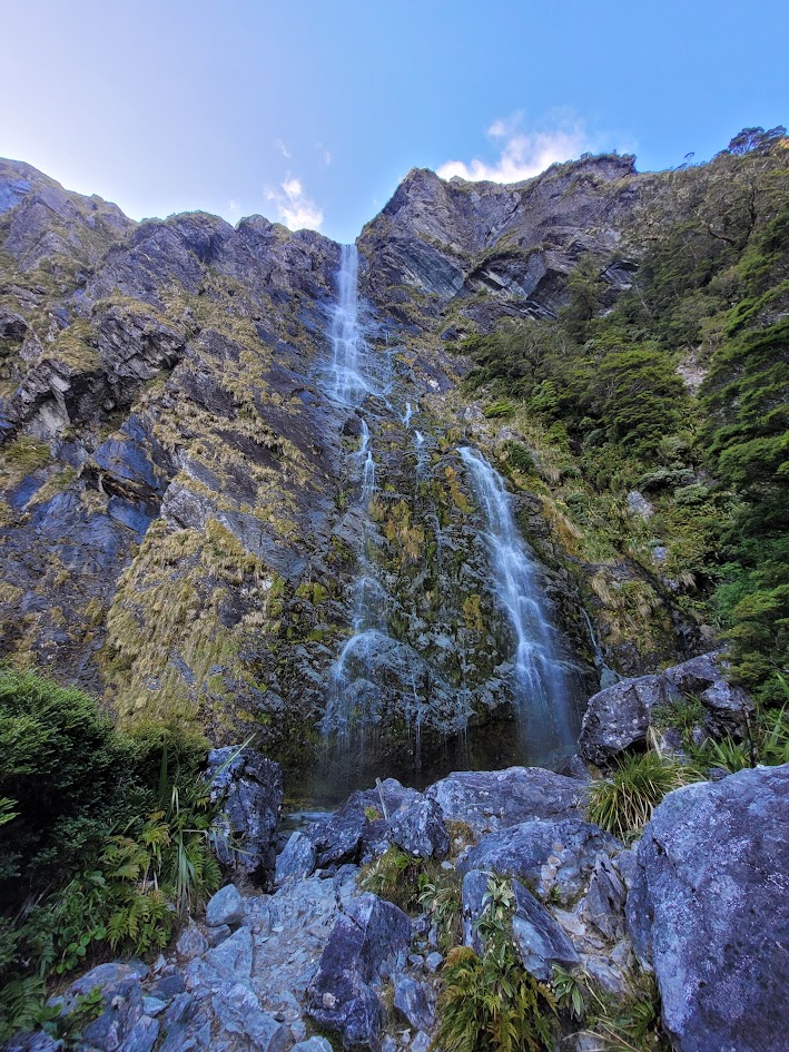
Fantail Falls and Thunder Creek Falls
The next day the guys did a trip through Wilsons Canyon, I was feeling a little uncomfortable about the higher water grade of Wilsons, so decided again to sit this one out and have a rest day. I ended up exploring a few of the waterfalls nearby!
Fantail Falls
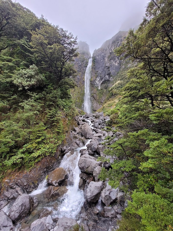
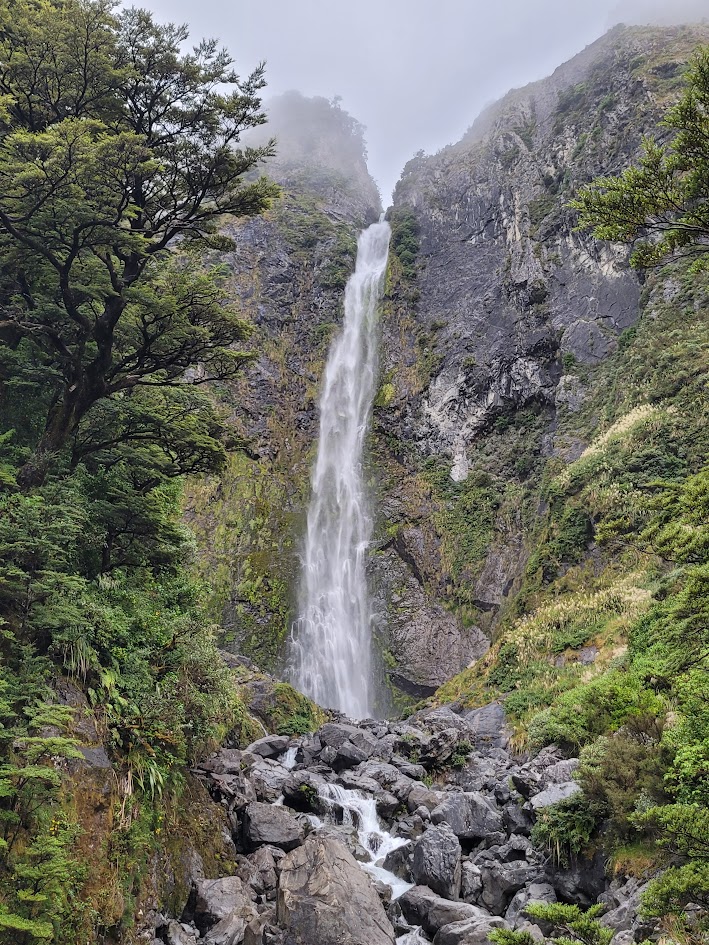
Thunder Creek Falls
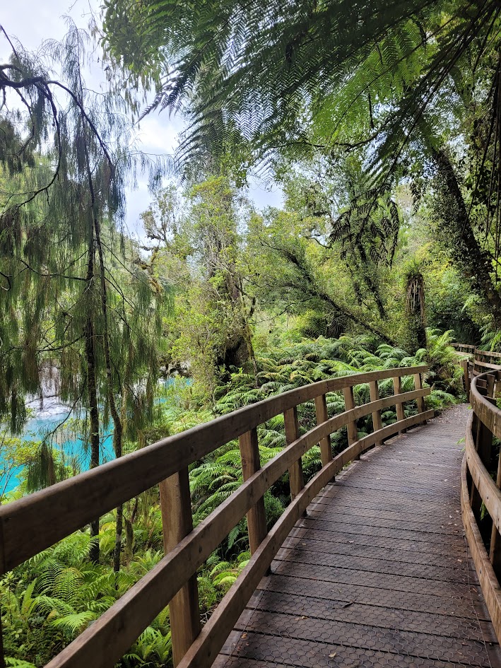
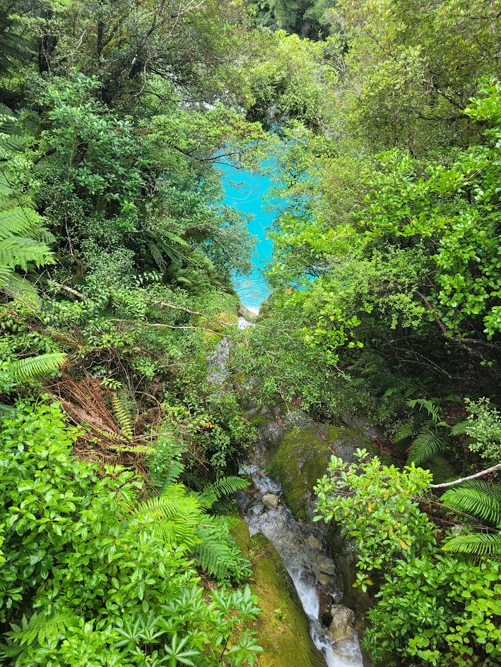
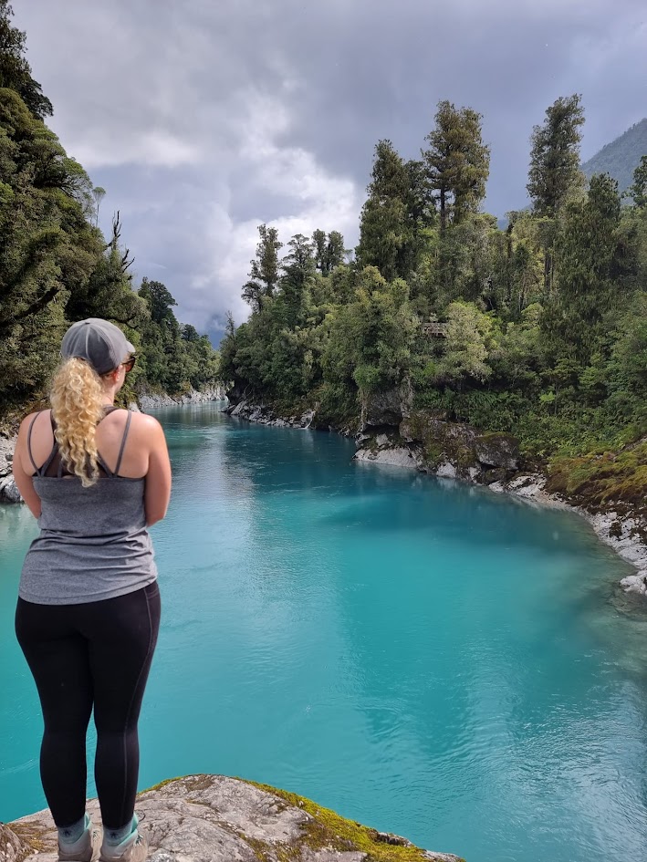
Hokitika Gorge
As we were travelling up the West Coast of New Zealand’s South Island, a visit to Hokitika Gorge was a must.
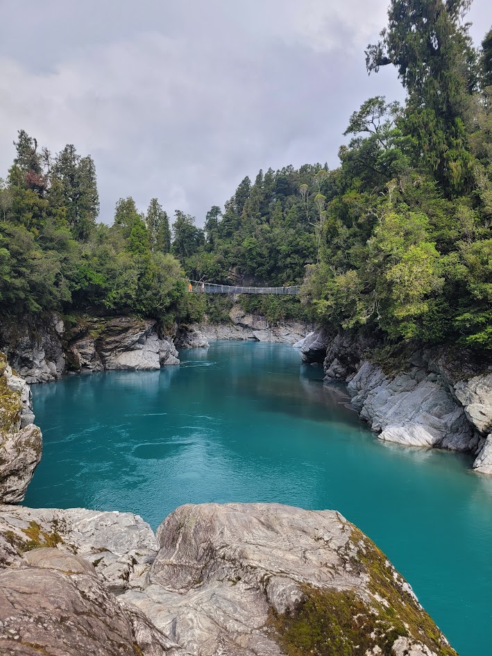
The colour of the water is so magical… its hard to believe its real.
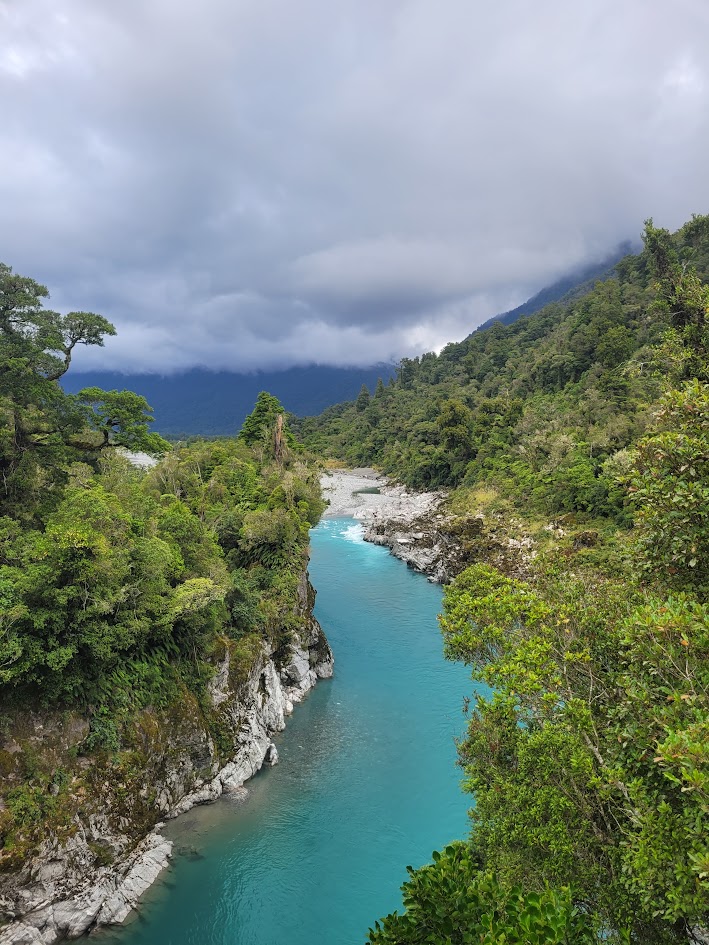
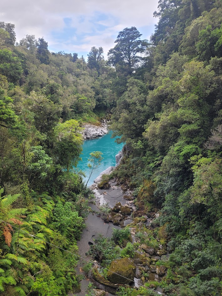
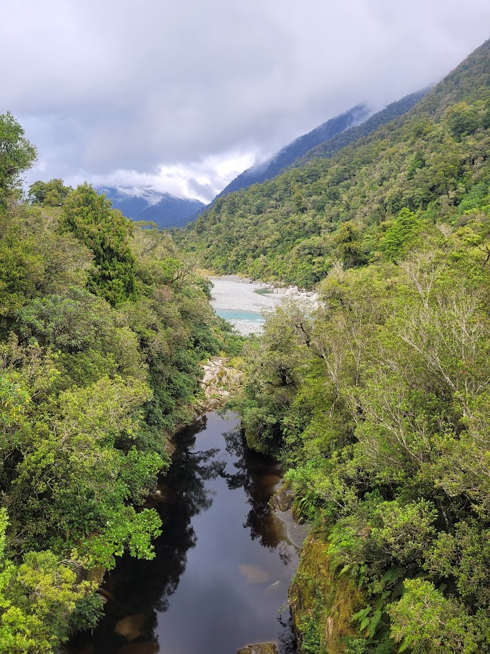
I thought it looked so bizarre how this black stained creek was flowing into the vibrant blue gorge but didn’t seem to dull the overall vibrancy?!
Carew Creek Canyon
Now higher up on the West Coast, it was time to check out another local canyon!
Carew Creek Canyon definitely had a very different look and feel to the Haast Pass canyons we were spoilt with a few days earlier, but it was still quite a beautiful and pleasant canyon trip!
One thing I really love about canyoning, is how you get to see and experience waterfalls you would never get the change to see otherwise. This canyon had some beauties!
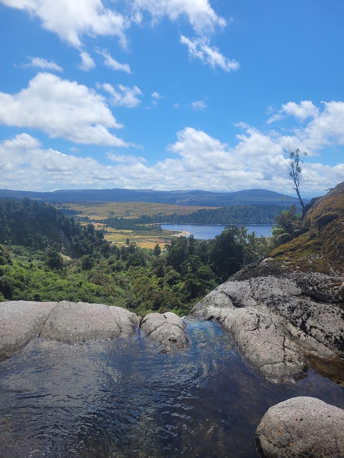
With views down to Lake Brunner the whole way. The final abseil was Carew Creek Falls which can be visited via a well formed tourist track.
Ford Creek Canyon
On the same day at Carew Creek Canyon we decided to quickly visit Ford Creek as they were reasonably close together.
Ford Creek is a pretty and interesting canyon, but is just a simple out and back canyon without any abseils.
It was quite close to a small town, and I remember it feeling oddly dirty whereas other New Zealand canyons make you feel cleaner than when you first started!
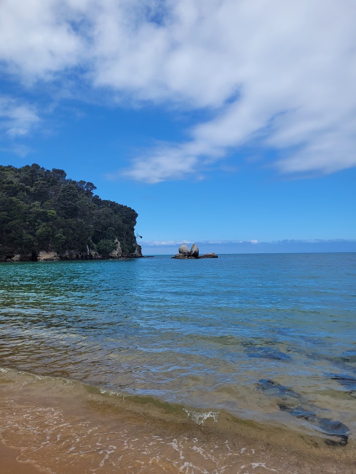
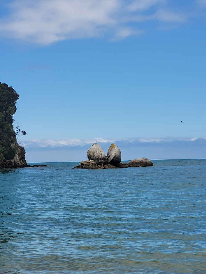
Split Apple Rock
We made our way to the top of the South Island! So decided to be proper tourists for the day and visit Split Apple Rock.
Harwoods Hole
We also couldn’t help ourselves but visit the legendary Harwoods Hole, New Zealand’s deepest vertical shaft, dropping approximately 176 – 183m into a massive cave system on Takaka Hill.
You can hike to Harwoods Hole on a well formed 2.2km hike through the forest, ending at an unfenced viewpoint over the huge chasm.
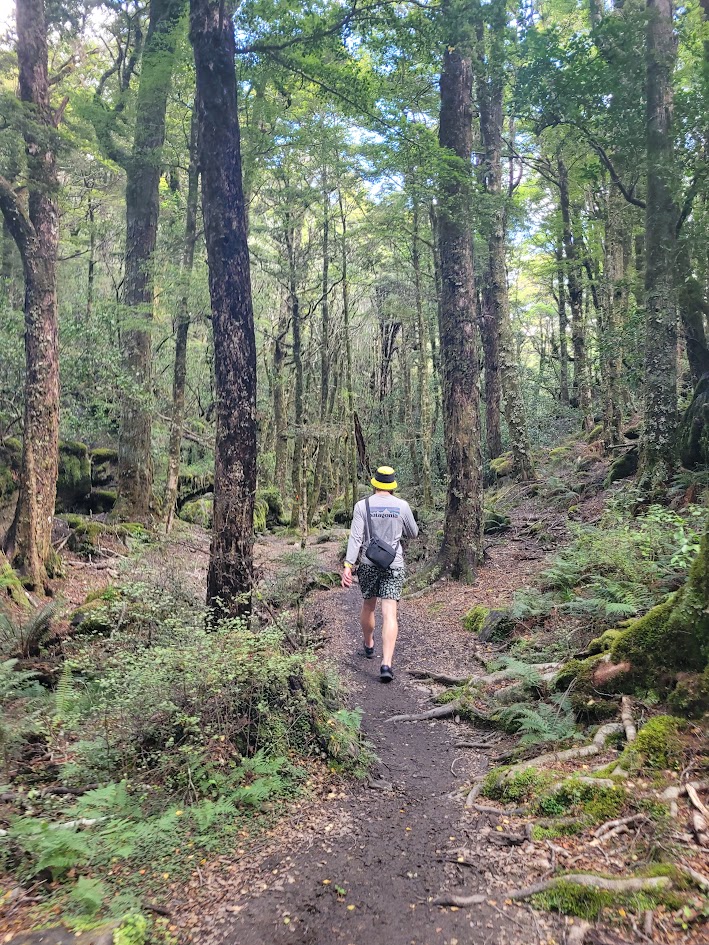
The forest walk was super beautiful, but for some reason felt so much longer than 2.2km.
Above is the rocky viewpoint into the chasm, for some reason I didn’t take any photos into the actual hole itself (I might have been worried about dropping my phone!).
You can actually abseil into this chasm, which is WILD and I would love to do one day. Once you abseil in you navigate your way through the cave system to exit, which is very popular for cavers and canyoners alike!
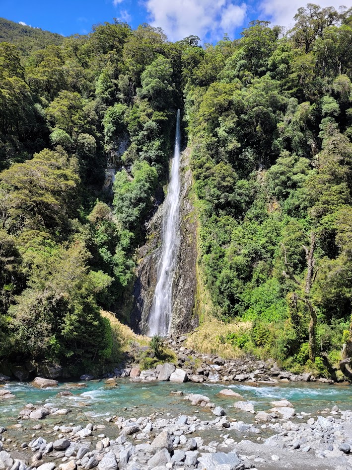
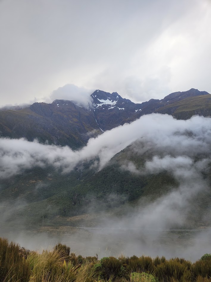
Twin Creek Canyon
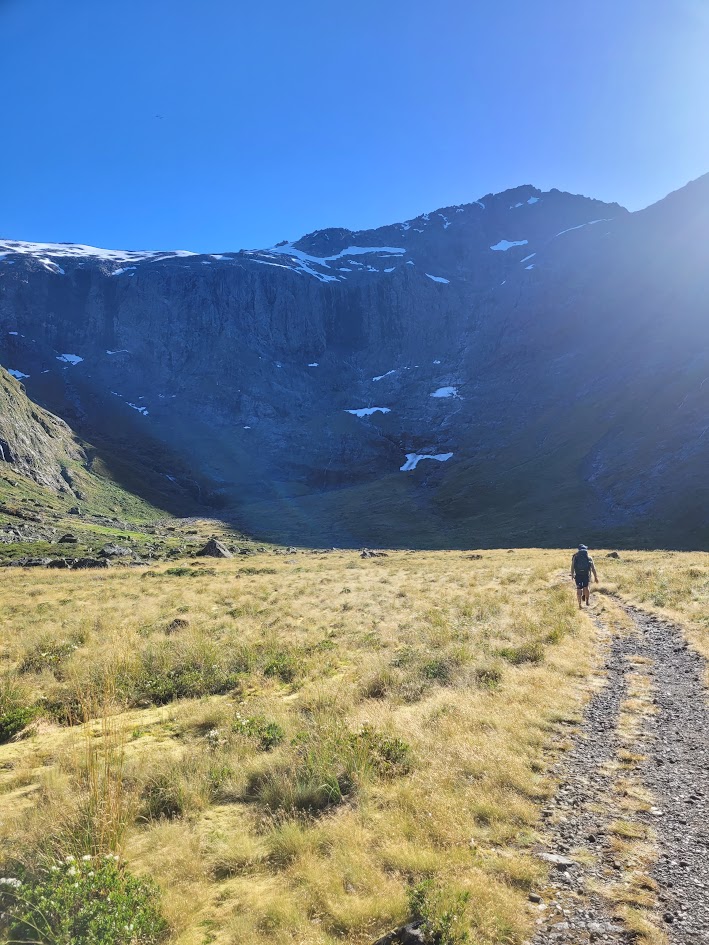
We found ourselves heading further south through Arthur’s Pass, on our way to check out another canyon.
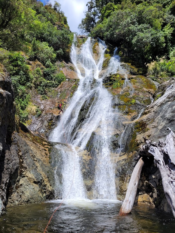
Twin Creek Falls is a huge 115m waterfall, but there is a sweet canyon you can do higher up on the creek and exit just before the main falls. I believe this canyon is split into an upper and lower section, so on this trip we just did the lower section.
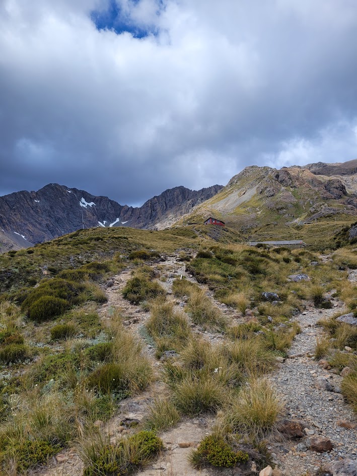
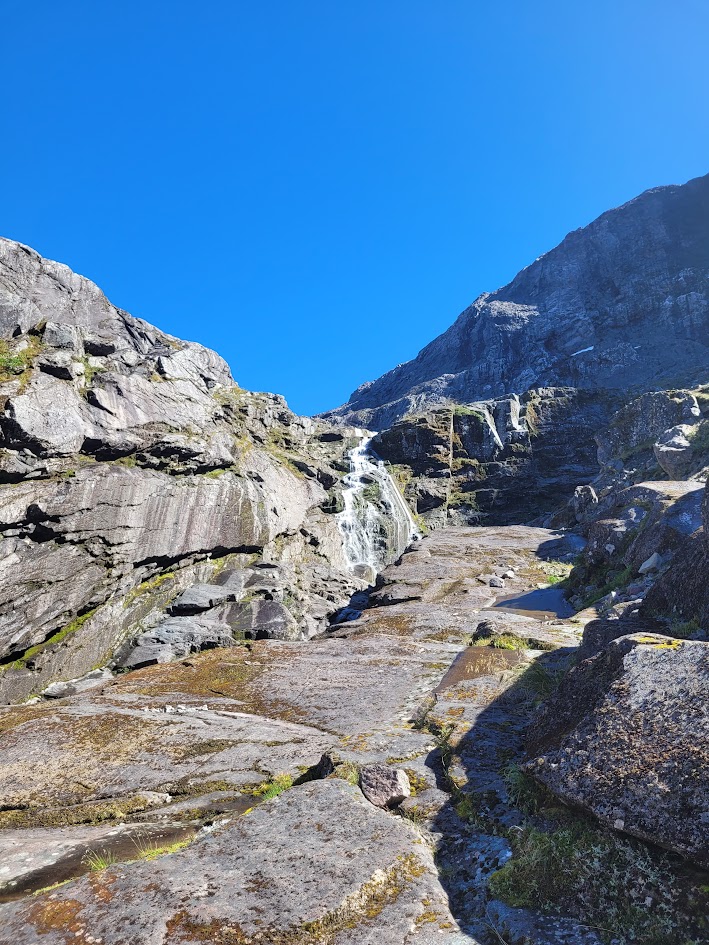
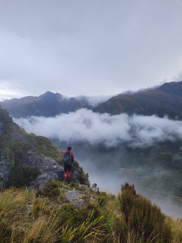
The trip begins with a pretty big hike up to the Temple Basin Ski Resort, 5.3km in length and 488m of elevation! It was punchy and I started to feel quite sick on the way up.
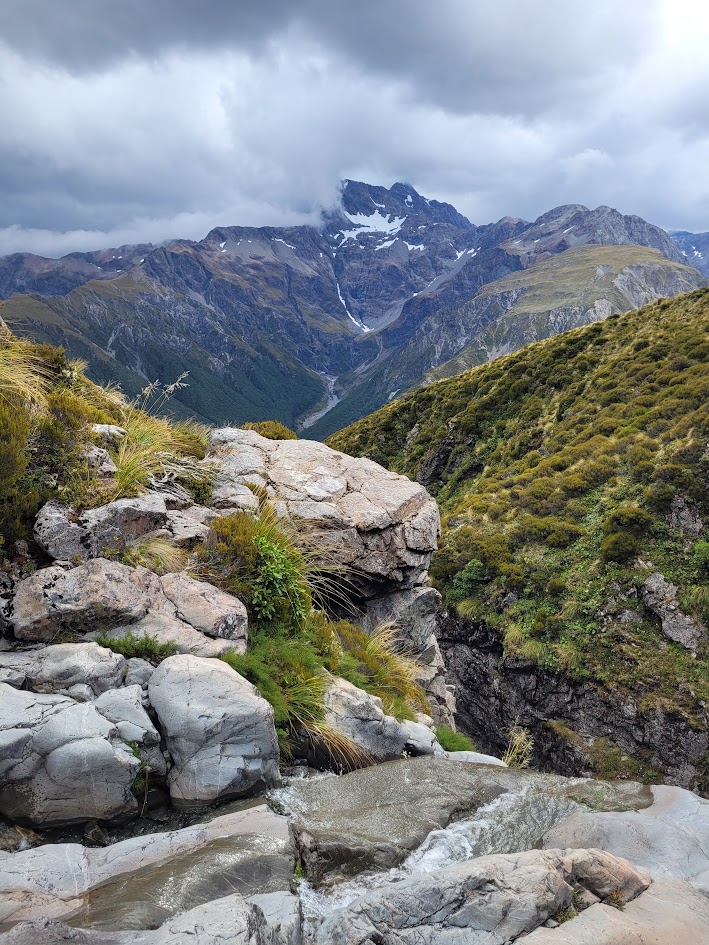
I’m glad I persevered as this ended up being one of the best canyons I have ever done. Just look at those views!!! That is one hell of a starting view, which I believe is out to Mount Rolleston.
Super enjoyable waterfalls and abseils. With snow covered mountain peak views the whole way down.
Just as we reached the middle of the canyon it started to rain. Usually rain in a canyon would cause me to stress but this was surprisingly peaceful. I think as the gorge was quite open we weren’t super enclosed and near the end.
These are some of my favourite photos from the whole trip. Which is saying A LOT.
And then we were at the top of Twin Creek Falls!
The mist and cloud rolled in post light rain which created the most dreamy and moody scenes.
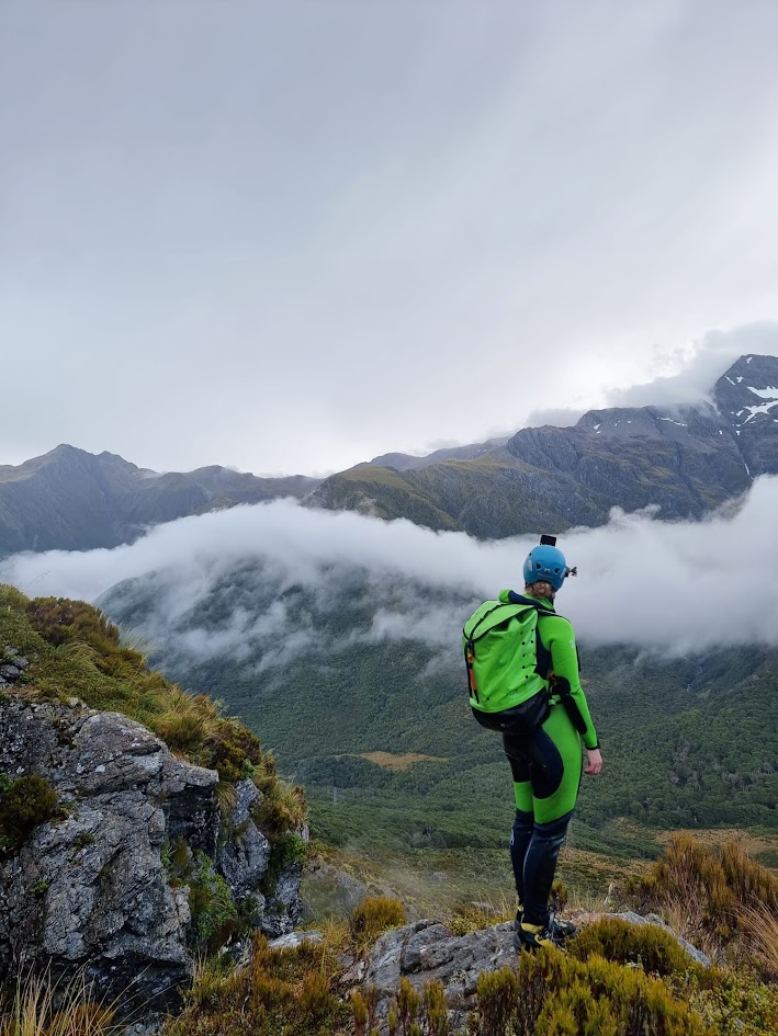
And then we experience a near total white out! Time to head back down to the van we think.
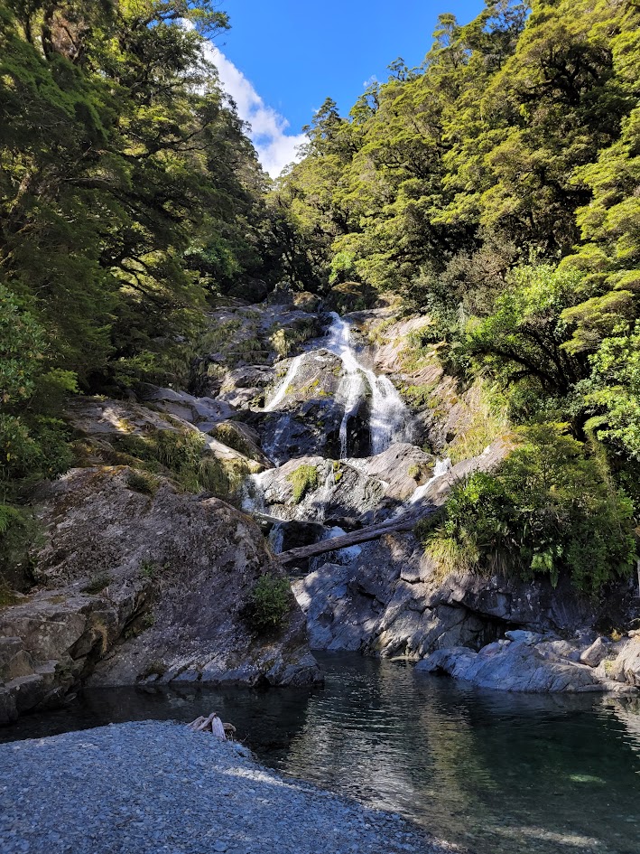
Devils Punchbowl Falls
I am honestly not sure how I had the energy, but after the canyon and from camp, I decided to go for a quick solo hike to visit Devils Punchbowl Falls.
It was only a 2.1km out and back return hike, with 113m of elevation gain.
Well worth the effort in my opinion!
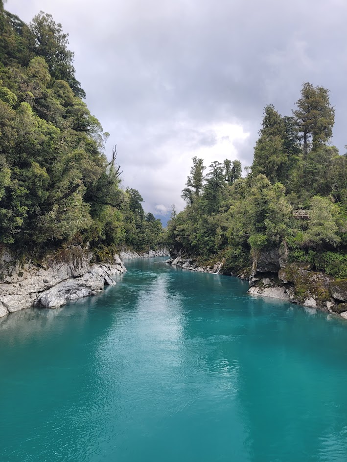
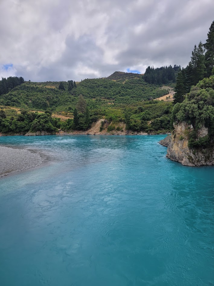
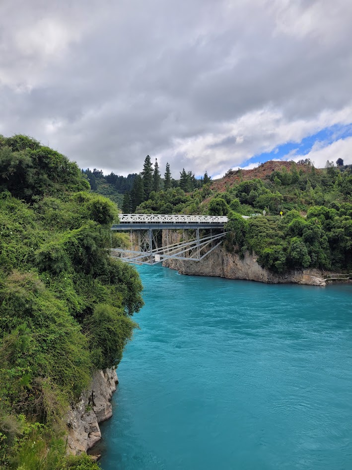
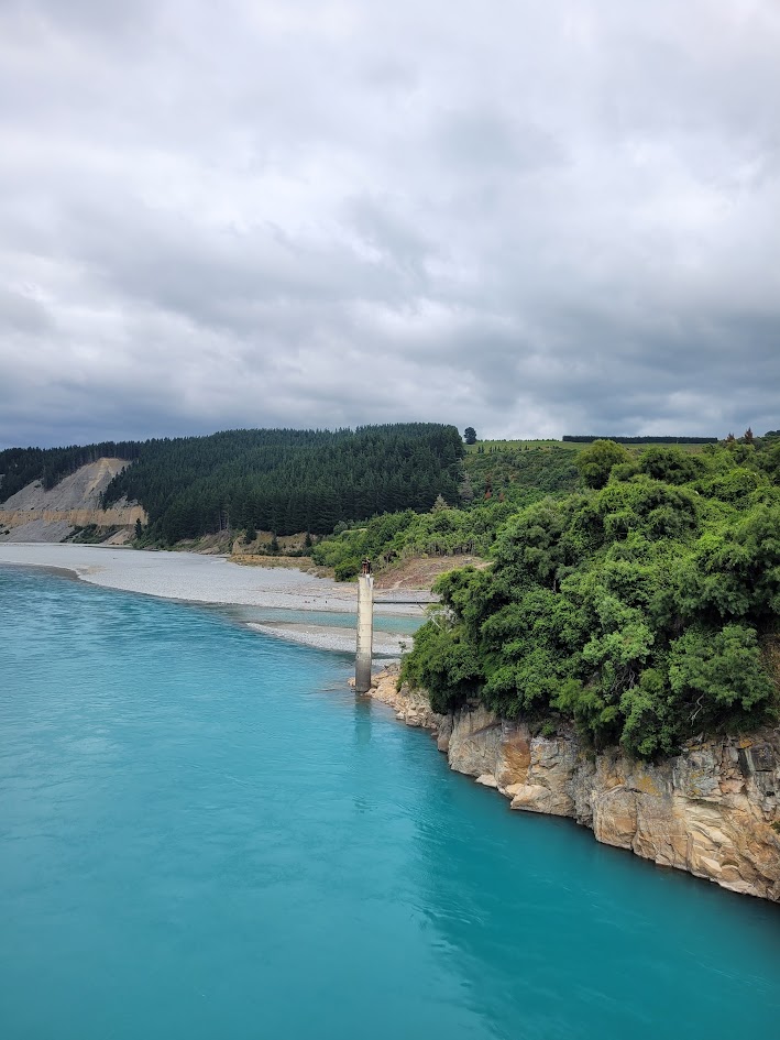
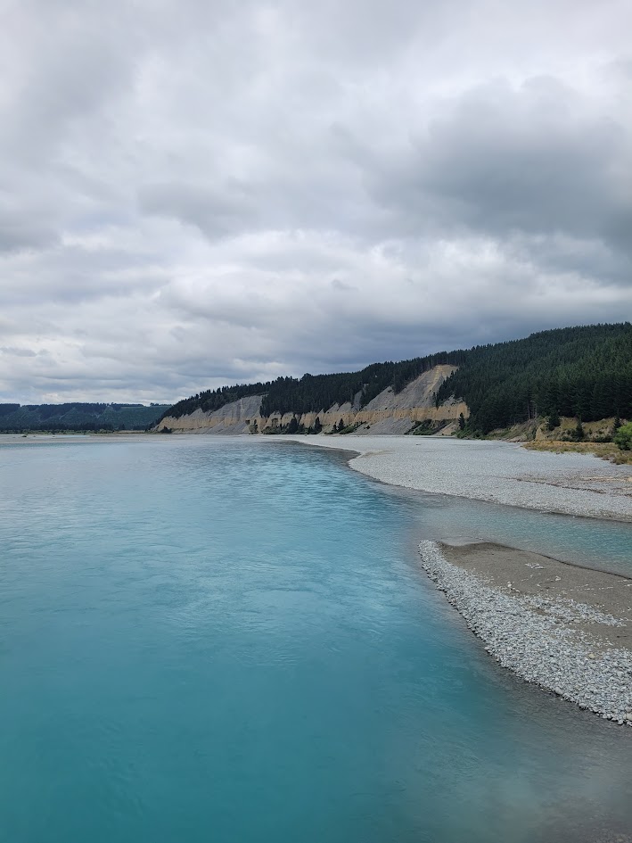
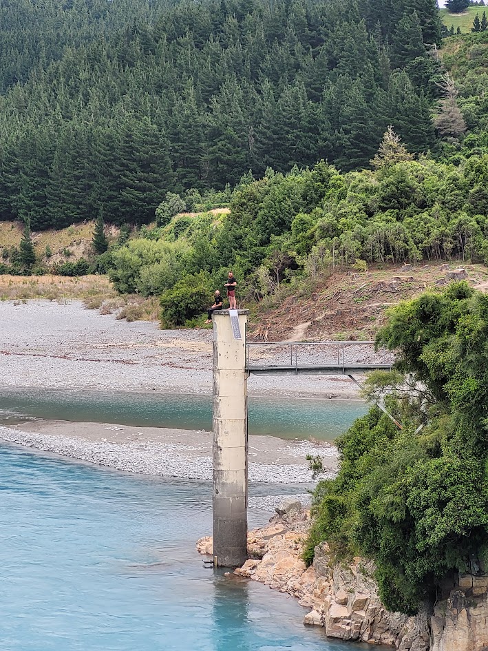
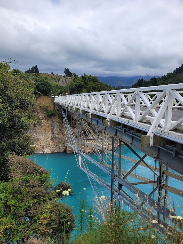
Rakaia Gorge
If you loved the turquoise blue water of Hokitika Gorge, then you will also love Rakaia Gorge!
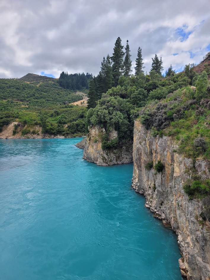
Honestly… how is New Zealand even real?!
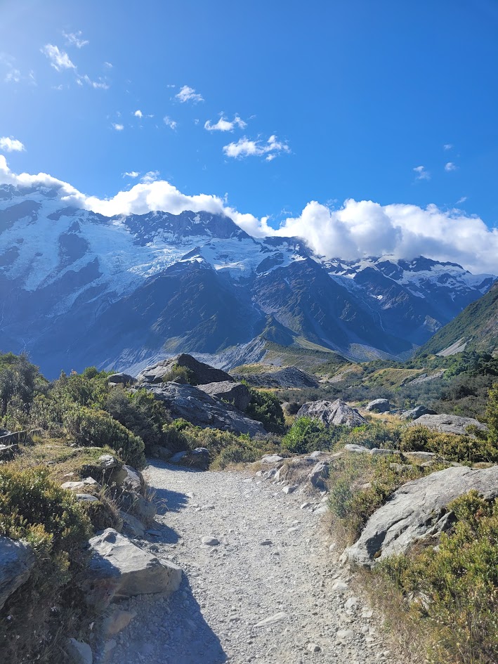
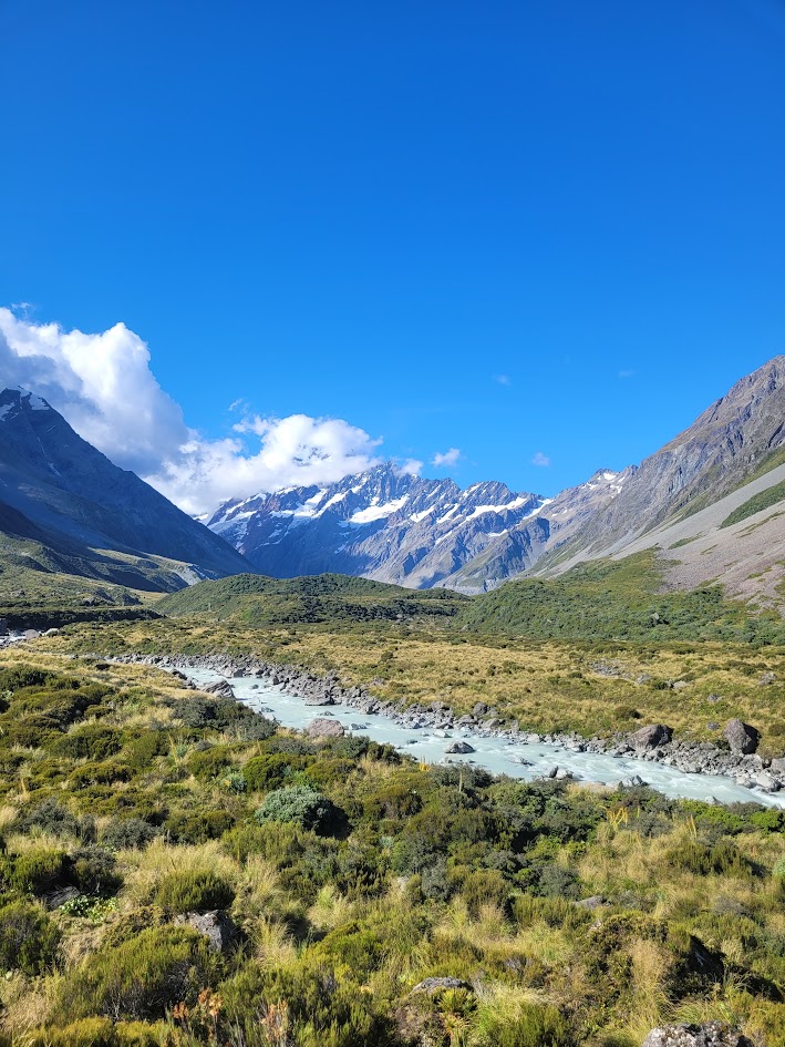
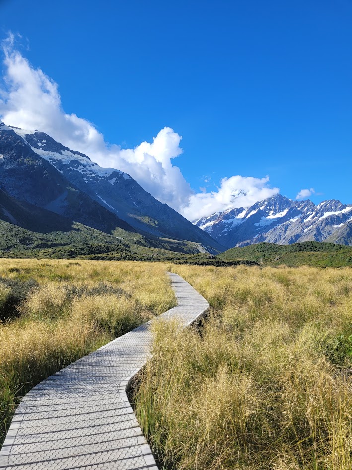
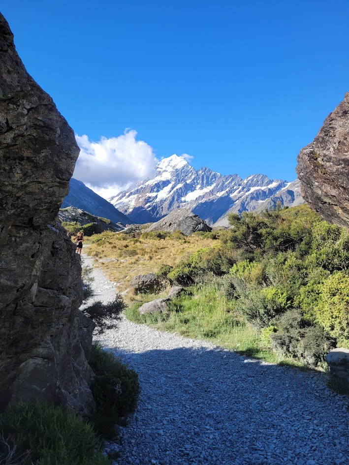
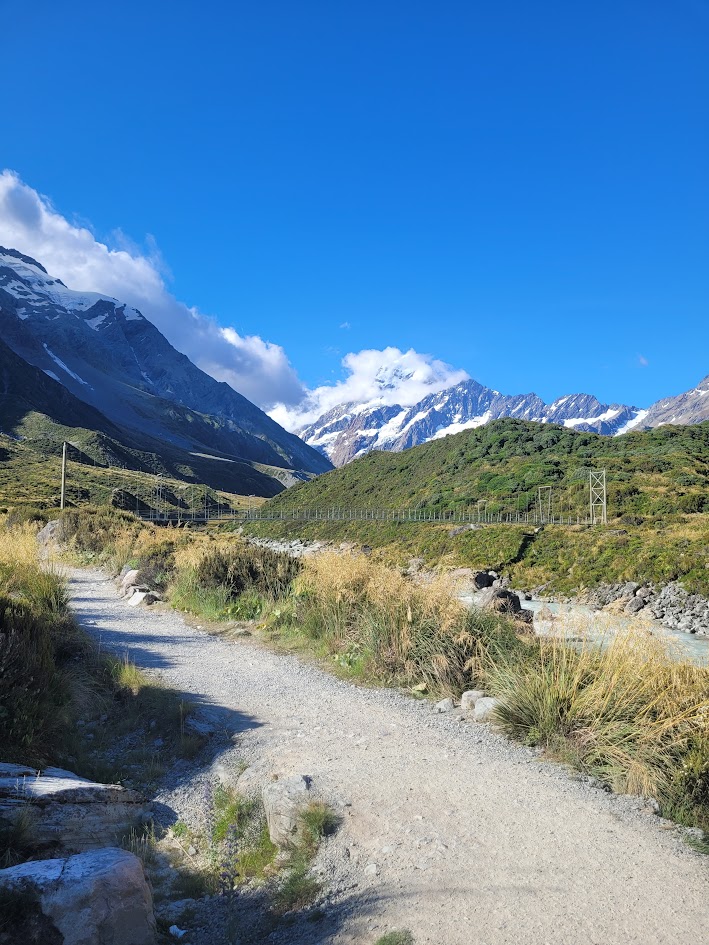
Hooker Valley Track
As we were heading back down towards Queensland, we had a quick stop in Mount Cook National Park. I dropped the guys off to complete Sawyer Stream Canyon, but decided I needed a more relaxed adventure… so I went to hike the Hooker Valley Track!
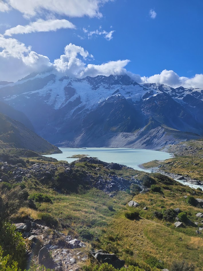
It was a super cruisey 10km return hike, with epic views of Mount Sefton the whole way.
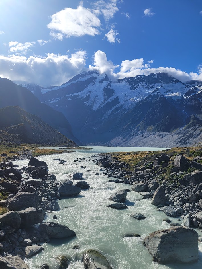
Coming from inland Australia you never really get used to these mammoth snow capped mountain peaks and glacial rivers.
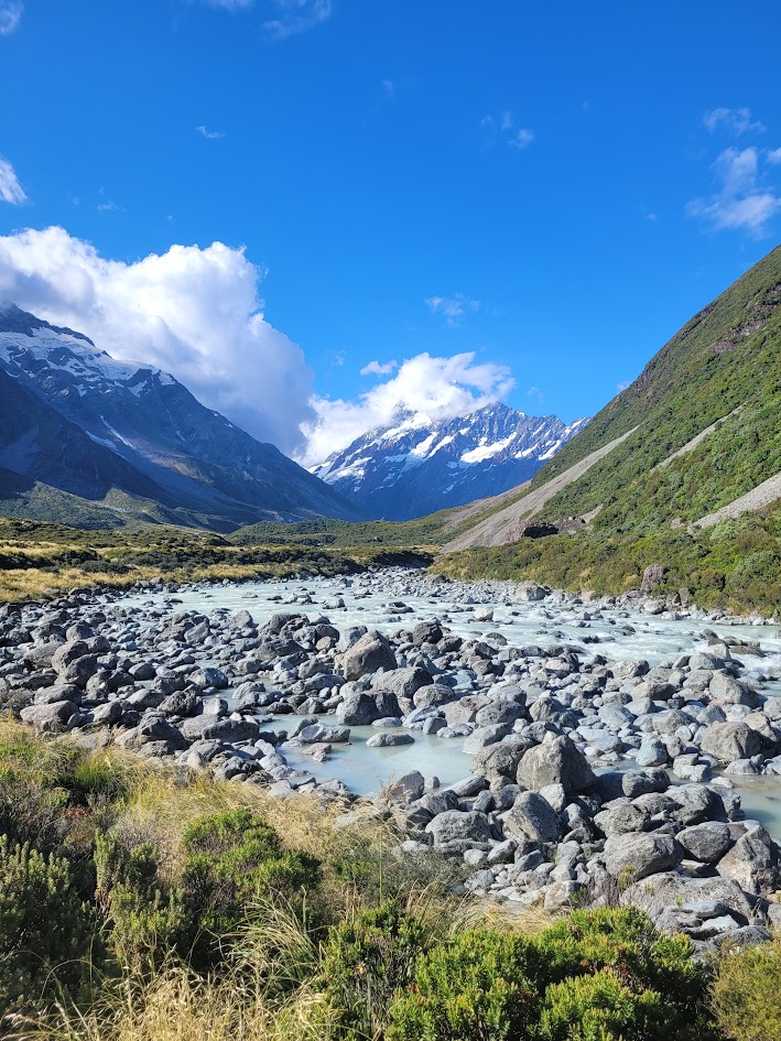
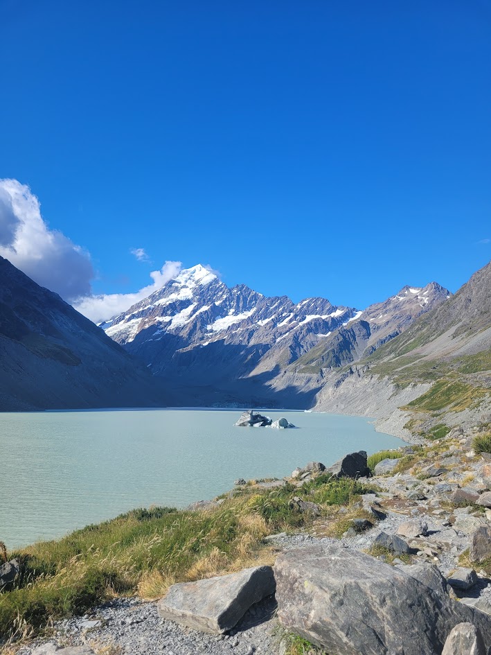
Can you believe this was my first time ever seeing an ice berg!!
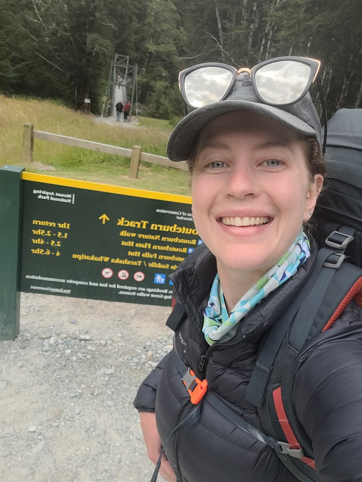
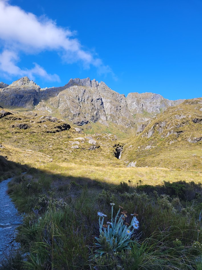
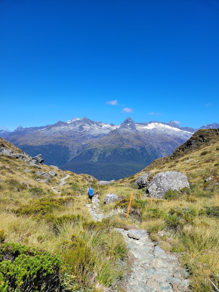
Routeburn Track
Surely the only way to appropriately finish an incredible 3 weeks on the South Island is to complete another NZ Great Walk?!
Unfortunately we booked quite late in the season so we weren’t able to align dates for the campgrounds (had no chance staying in the huts) which meant the guys set off a day before me, and I was hiking the Routeburn solo!
Day 1
Considering this was my first time ever solo multi-day hiking, in a different country, I don’t recall being nervous at all. BUT WHY DO I HAVE THOSE SUNNIES! Hahaha.
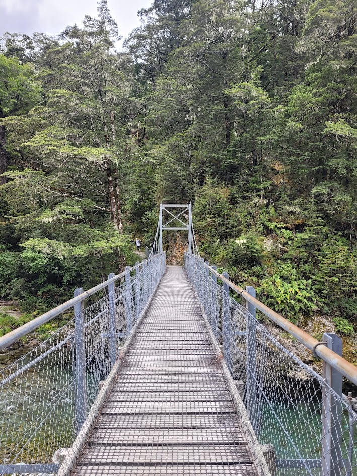
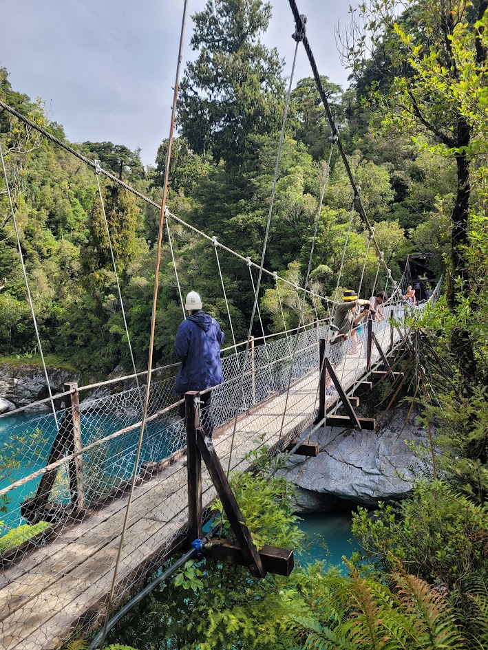
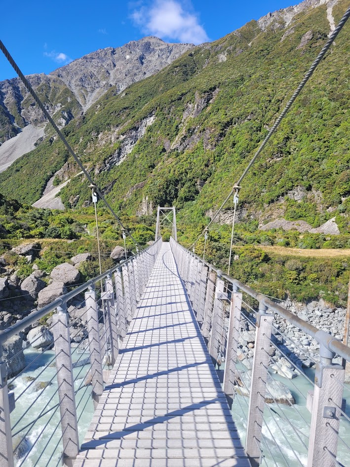
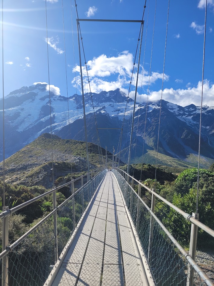
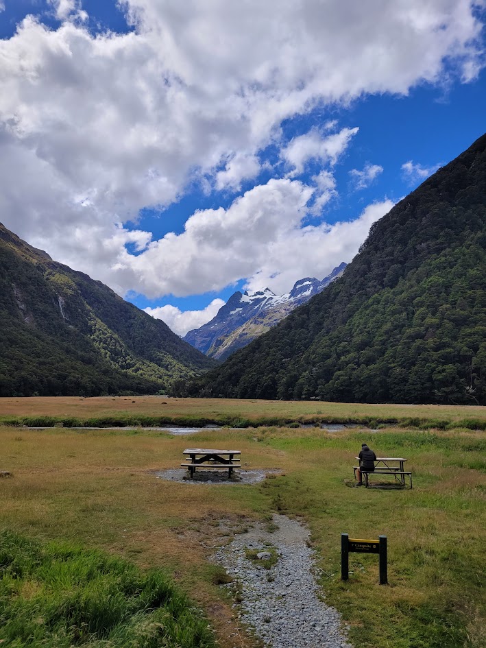
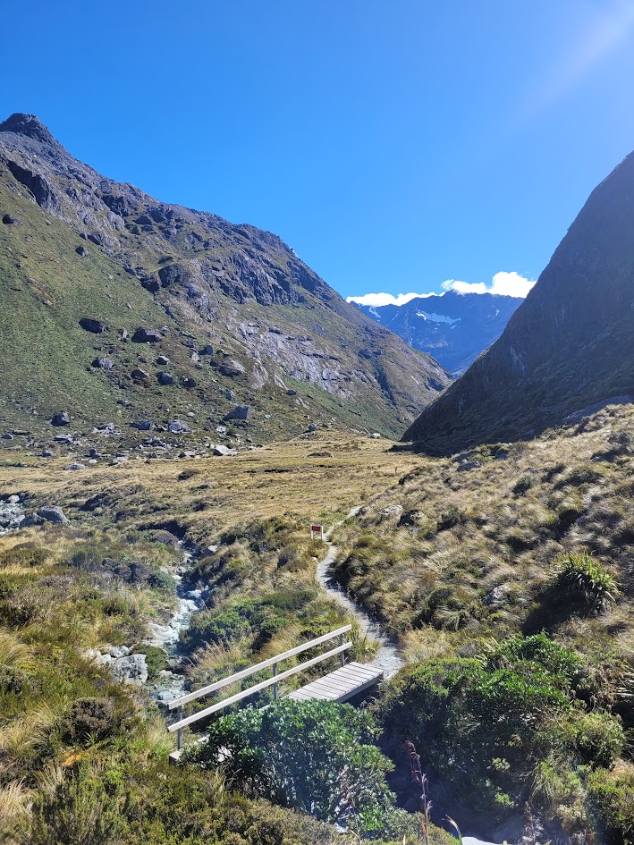
The first day was pretty cruisey, I only needed to hike 5km to the Routeburn Flats Campsite. The walk was pretty easy going and featured even more famous NZ swing bridges!
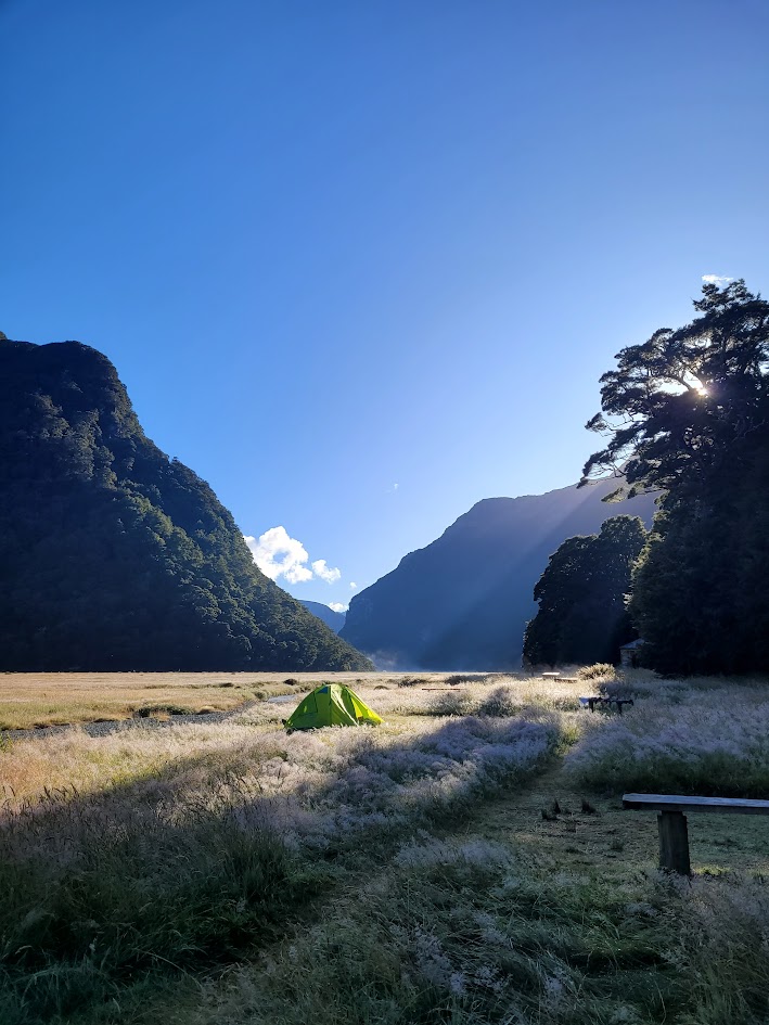
I started the day very early for such a small walk and as I got to Routeburn Flats hut it started to bucket down with rain, so I sought shelter and had some snacks and a nap to wait it out. It finally cleared and these were the camp views!
Day 2
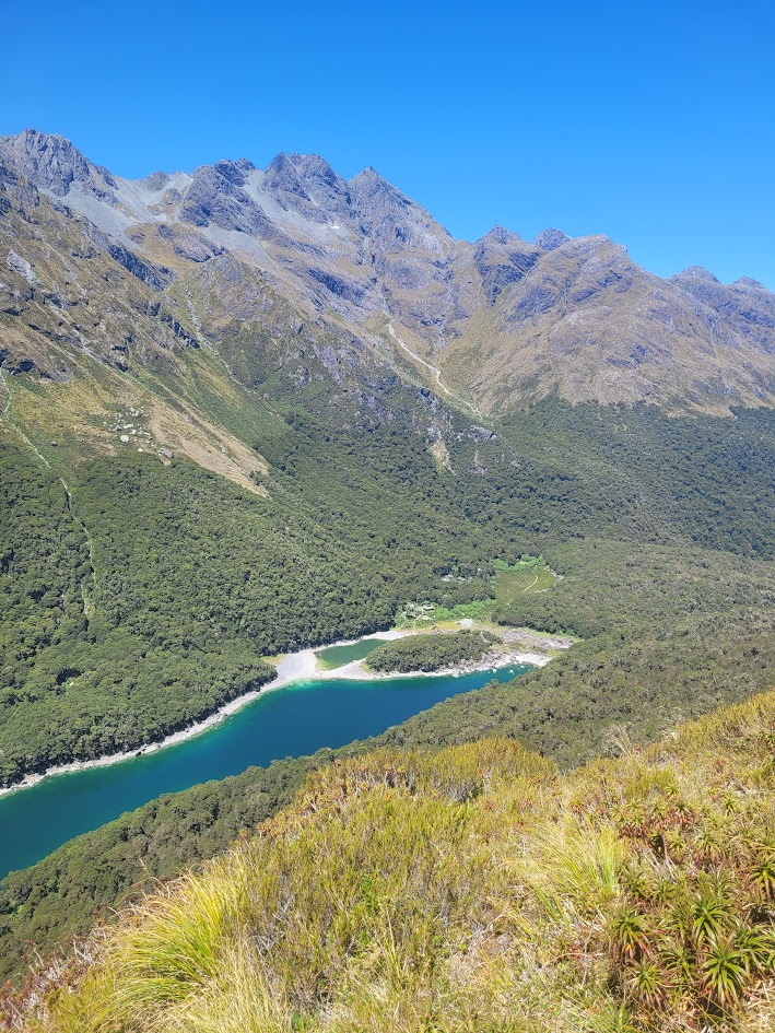
The next morning the camp views got even better.
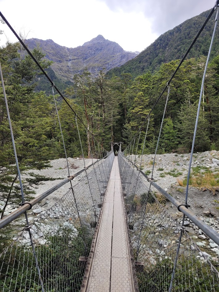
The hike then climbs up to Routeburn Falls Hut and onto Harris Saddle. Day 2 is by far the hardest day with the majority of all the elevation, but compared to the Kepler Track and non-stop hiking the last few weeks it felt quite easy.
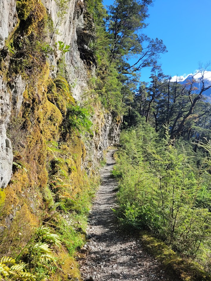
The track leading up to Routeburn Falls Hut is quite pretty!
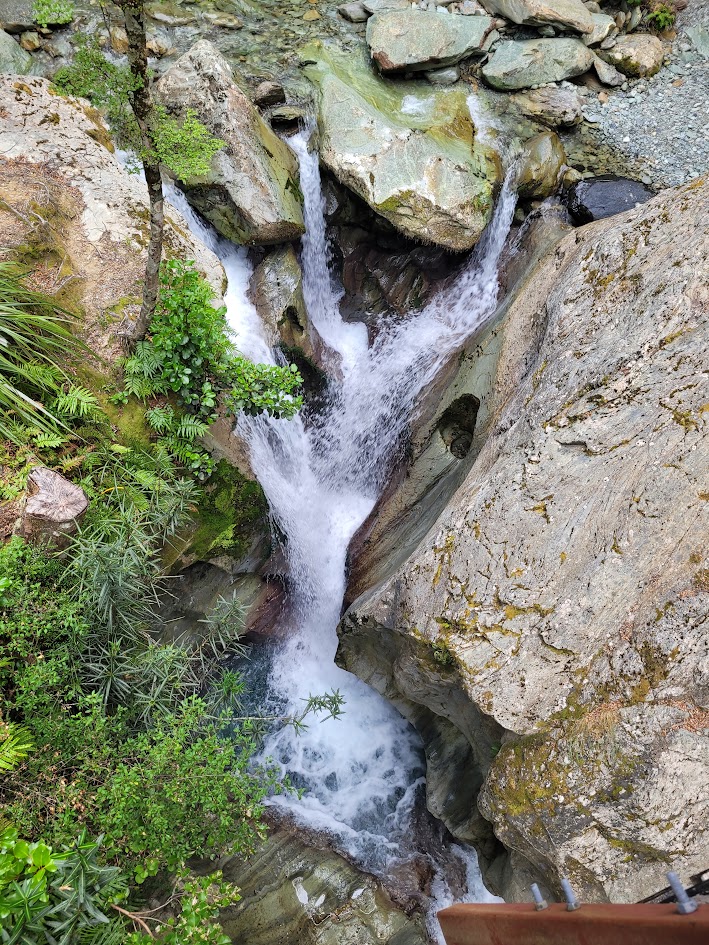
A small part of the beautiful Routeburn Falls.
The track then winds its way through a beautiful mountain valley on the way up to Lake Harris. The guys the day before passed through this valley in torrential rain, so I was quite lucky with the weather I got!
There were some hikers hiking the track in the opposite direction, staying at Routeburn Falls Hut, who were hiking back up in the valley to see the views as the weather the day before was so bad.
First sightings of Lake Harris! I’ve since learned there is another alpine Lake even higher than Harris, called Lake Wilson. I would love to get there one day.
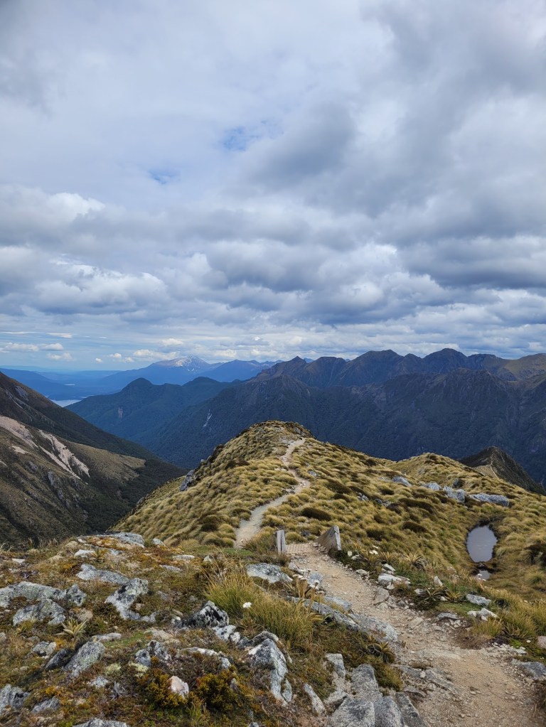
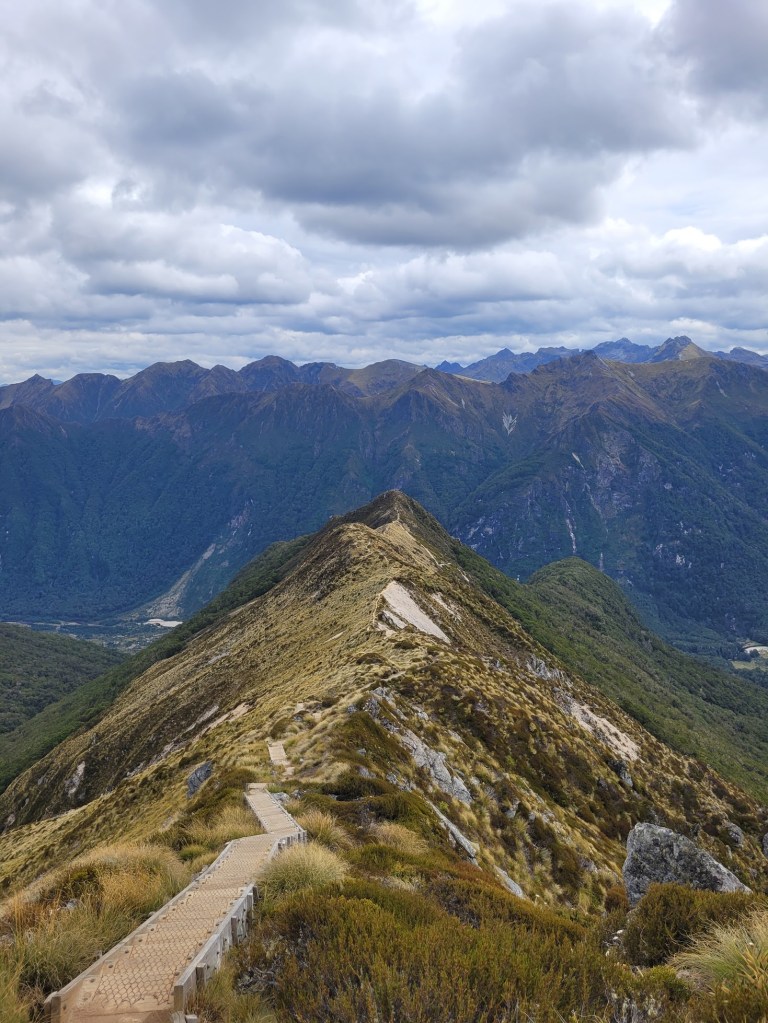
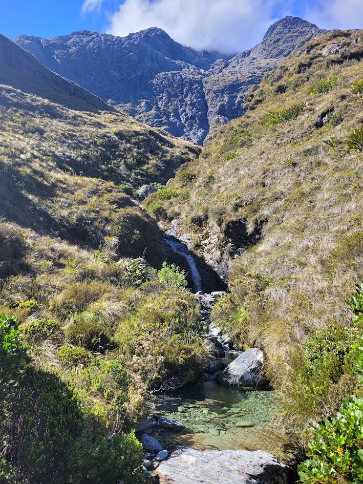
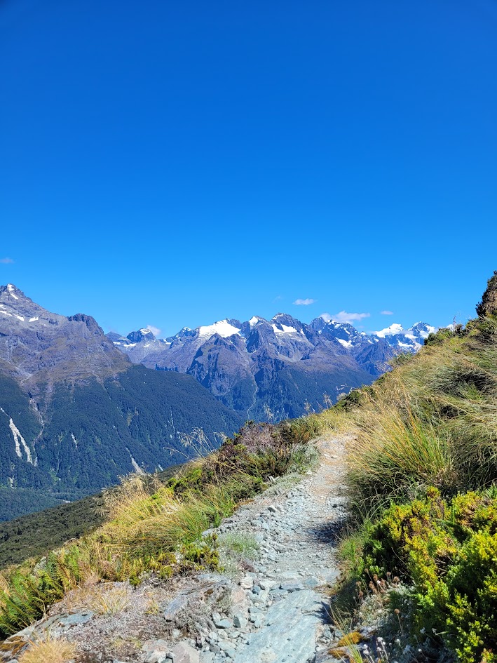
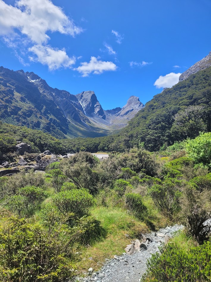
Then onto Harris Saddle, and past Harris Shelter. The views walking over the ridge onto the shelter were some of the most beautiful of the whole trek. Some hikers were taking the side trail up Conical Hill which made me feel very impressed with their fitness levels, and quite happy to give a miss looking at the steep terrain.
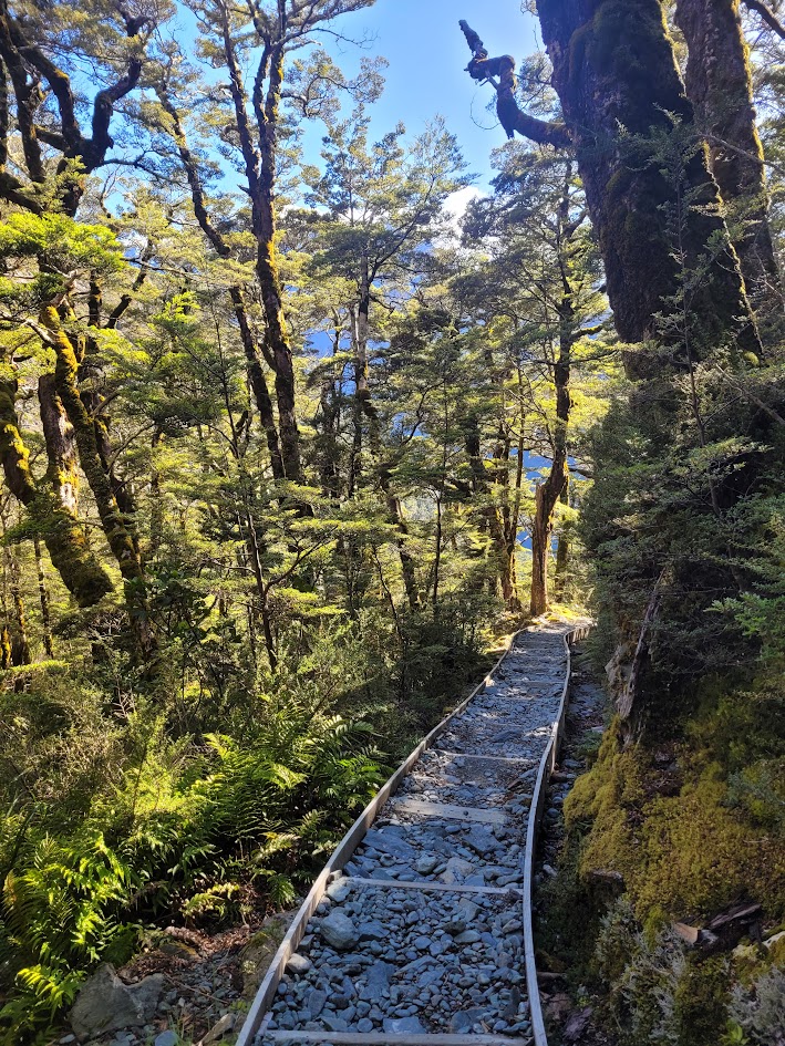
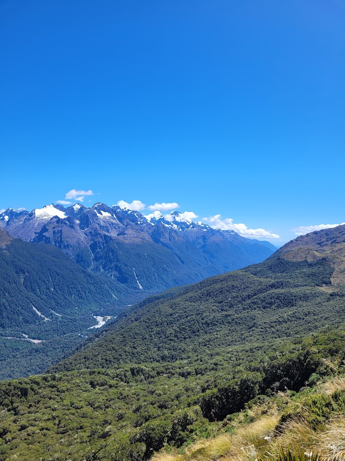
The hike then flattens out, and cruises along and traverses one of the most picturesque mountain valleys.
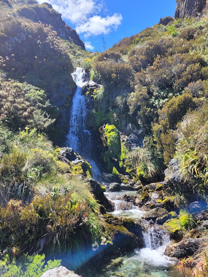
Of course there were more waterfalls!
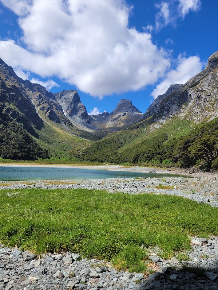
The first view of Lake Mackenzie and camp for the night! With a HUGE descent down off the mountains.
I had a cozy nap in the grass on the edge of Lake Mackenzie. Happy little hiker.
Day 3
The last day on trail!
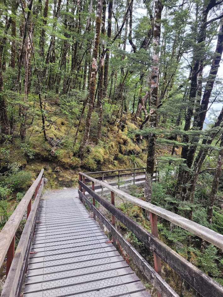
The scenery this morning was quite different to the other mornings so far. Walking out from Lake Mackenzie was quite beautiful, and as much as I love the mountains I was looking forward to walking out through the forest again.
There were still plenty of mountain views on this final stretch of the hike!
First glimpse of Earland Falls! One of the highlights of the Routeburn Track.
A mammoth 174m drop. Unfortunately it was quite dry when I did this hike, though I’ve seen photos of it absolutely thundering down the mountain.
The view past Lake Howden was prettier than I was expecting, and I didn’t realise there was also a campsite here, though I don’t think it forms part of the Routeburn Track as you would be so close to the trail end/start here, though I might be wrong.
One last final glimpse of the mountains! The end of the hike really drags on right before reaching The Divide Carpark, but what an epic 3 days on trail!
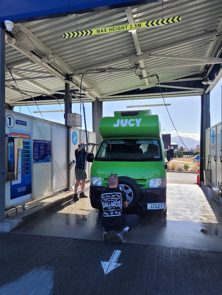
We had one more rest day in the South Island before flying home, which meant a quick wash and some TLC to our beloved Jucy Lucy.
What an unforgettable 3 weeks exploring the South Island this was.


Leave a comment